Clouds on the increase Wednesday ahead of a potent Christmas Eve storm system
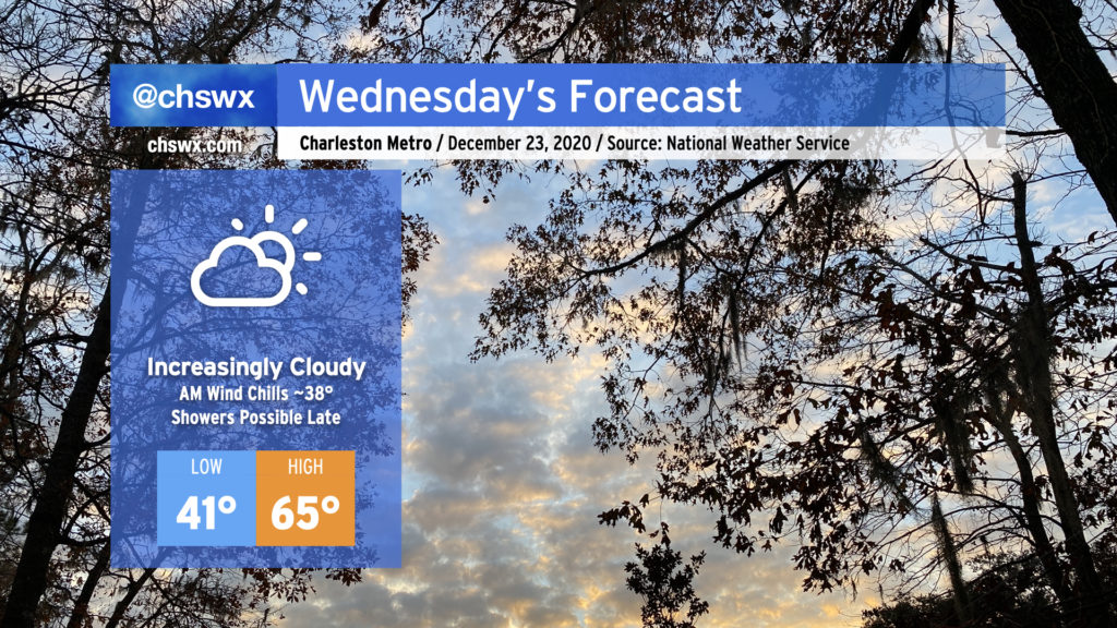
Wednesday will be the last rain-free shopping day before Christmas. Cloud cover will be filling in as the day goes on ahead of what looks to be a fairly potent storm system for Christmas Eve. Temperatures around the area will start out chilly — low 40s, with wind chills around 37-38° possible with a light breeze — before warming into the mid-60s despite the cloud cover. A shower or two can’t be ruled out closer to midnight Wednesday as well.
Christmas Eve storm ushers in very wintry air for Christmas Day
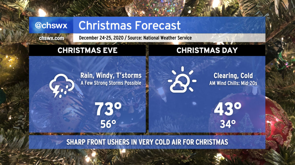
This is going to be a bit of a rough-and-tumble Christmas, as a strong storm driven by a highly energetic upper-air pattern moves through the area on Christmas Eve, leaving very cold air in its wake.
Risk for strong storms on Christmas Eve
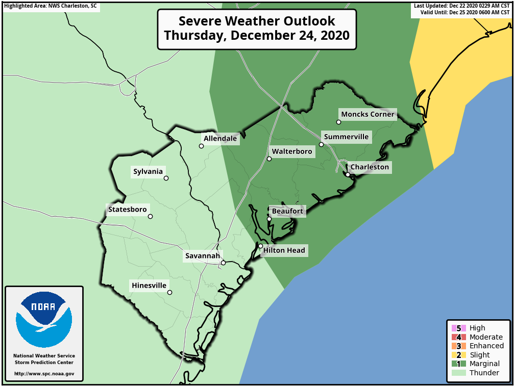
Thunderstorms are starting to look a little more likely given ample wind shear and perhaps a little bit of surface-based instability developing ahead of the line. While it appears that the bulk of any severe weather will be found northeast of the Tri-County area (where the Storm Prediction Center has outlined a slight risk [2 out of 5] of severe storms), there will be the potential for a few strong thunderstorm wind gusts to bring down trees and power lines.
Even outside of thunderstorms, winds should gust consistently over 30-40 MPH ahead of the line as a 55-knot low-level jet moves overhead. This wind could play havoc with Christmas decorations, so if there are any you are concerned might come loose, consider reinforcing them or removing them.
Further to the northeast, there will be the potential not only for strong, gusty winds but also a few tornadoes as you get into the Grand Strand and eastern NC. If you’re headed that way for the holiday, be sure to stay weather-alert on Christmas Eve!
Turning breezy and cold for Christmas Day
Once the front gets through late Thursday, winds will remain elevated and temperatures will plummet into the mid-30s by sunrise on Christmas. We could still see gusts around 20-30 MPH throughout much of the day as colder air rushes in. Don’t expect highs to crack the mid-40s despite rapidly clearing skies.
This is one year where the kids won’t mind wool socks under the tree, methinks.
Follow my Charleston Weather updates on Mastodon, Bluesky, Instagram, Facebook, or directly in a feed reader. Do you like what you see here? Please consider supporting my independent, hype-averse weather journalism and become a supporter on Patreon for a broader look at all things #chswx!