The week ahead: March doing March things

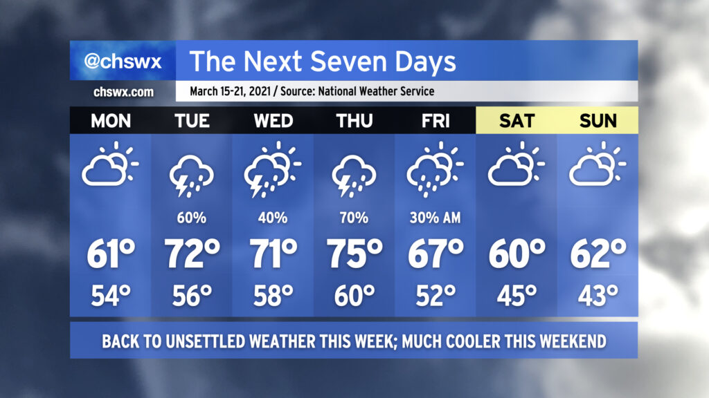
Unsettled weather returns to the picture this week as a series of fronts stall out across the area, bringing shower and thunderstorm chances starting late Monday into much of the rest of the week. Temperatures will be on quite the rollercoaster as well; after topping out at 80° today, we drop back to 61° for Monday as a cold air damming wedge builds southwest across the area, bringing cooler air and gusty northeast winds. Moisture will increase throughout the day, and we will begin to see showers possibly as early as Monday evening, with better rain chances arriving overnight into Tuesday.
After the stalled cold front lifts back north across the area as a warm front on Tuesday (and there is a big question on just how far north it will lift, perhaps making 71° a tad optimistic), low pressure will traverse the area, keeping showers and perhaps a thunderstorm or two in the forecast into Wednesday. We could see a line of strong to even severe storms swing through the area ahead of a cold front on Thursday; this will certainly be something to watch over the coming days, but it’s impossible to nail down the details this far in advance given consequential model timing differences (as one would expect at this range).
By Friday, another cool wedge of high pressure looks to build in across the area from northeast to southwest, keeping cloud cover around and temperatures down in the low 60s, well below normal for mid-March. I wouldn’t be surprised to see some shower chances enter the picture near the coast on Sunday, but right now the NWS forecast is rain-free.
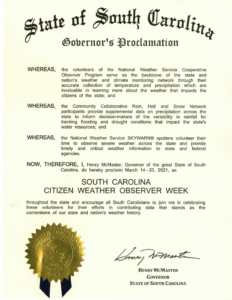
It’s South Carolina Citizen Weather Observer Week

Many thanks to the great folks at the State Climatology Office for sponsoring South Carolina Citizen Weather Observer Week, which runs from today through March 20. This week commemorates those of you who send in cooperative rainfall observations through the CoCoRaHS network, take detailed observations as cooperative weather observers, and give the National Weather Service critical ground truth as part of the Skywarn program. These observations make such an impact not only during weather events, but help climatologists understand the greater picture of soil conditions and any drought impacts on the state.
Want to join in?
When it comes to rainfall observations, there is rarely a such thing as too much data. The CoCoRaHS program involves taking daily precipitation measurements, which are immensely helpful for understanding drought conditions as well as helping to verify precipitation forecasts. I’ve been doing this for a few years and I’ve really enjoyed having my own reliable precipitation data to work with and share with the state climatology office as well as the National Weather Service. Join CoCoRaHS today and help South Carolina bring home the CoCoRaHS Cup (a real thing!) during their annual “March Madness” (no relation to the basketball tournament) membership drive.
Severe weather spotters are critical to understanding what’s happening on the ground. Radar can only tell a warning forecaster so much; ground truth helps to inform better warning decisions and can help save lives. The Skywarn program and its spotters are the eyes and ears of the National Weather Service. Want to train as a certified weather spotter? The National Weather Service in Columbia is teaming up with my friends at Carolina Weather Group for a virtual Skywarn training course on March 26. The course is free and open to all, and at the end, you’ll be a registered weather spotter for the National Weather Service. I hope to see you there!
Follow my Charleston Weather updates on Mastodon, Bluesky, Instagram, Facebook, or directly in a feed reader. Do you like what you see here? Please consider supporting my independent, hype-averse weather journalism and become a supporter on Patreon for a broader look at all things #chswx!