High pressure dominates heading into the weekend
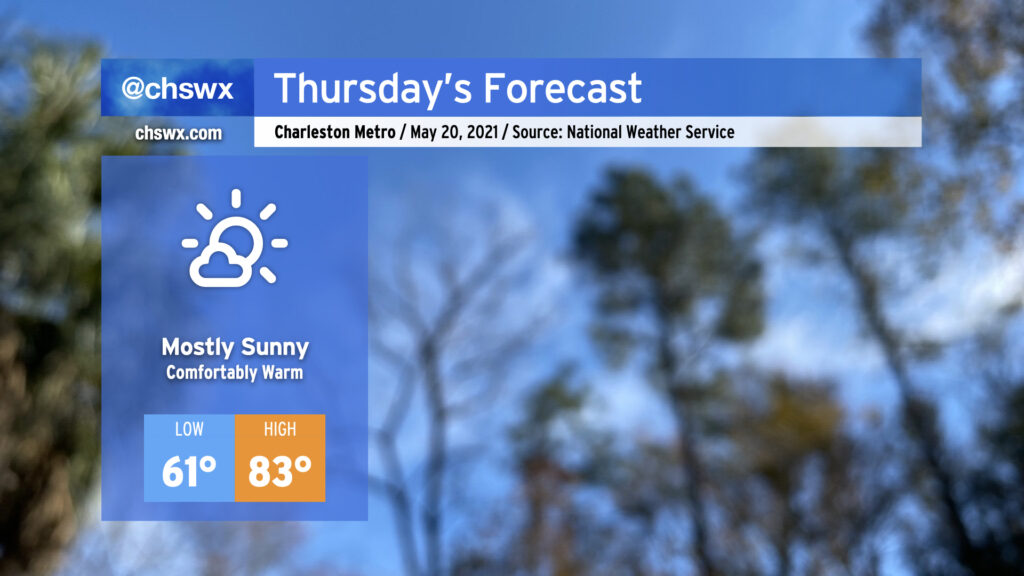
Thursday is looking quite good with high pressure beginning to assert greater control over our weather. The periods of showers we saw over the past couple days will be a thing of the past, and temperatures will remain comfortably warm with onshore flow. After starting the morning in the 60s, expect highs in the low 80s away from the immediate coast. Dewpoints in the upper 50s keep heat indices in check, making for a nice mid-May day.
Warming up as we get into the weekend
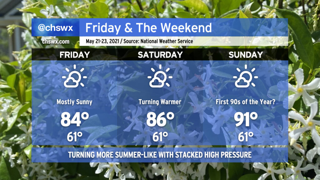
High pressure will keep its influence over the Eastern Seaboard for the foreseeable future. Heading into the weekend, we will see a noticeable warming trend take hold as a cutoff high pressure system takes hold over the Tennessee Valley. As the high retrogrades westward a bit on Sunday, we come under the influence of downslope flow, which will promote warming into the 90s across much of the area (away from the immediate coast). While some spots well inland have seen 90s back in April, we still haven’t reached that mark at the airport. Westerly winds with the aforementioned downsloping should keep the sea breeze at bay and allow the 90s to break through in more of the Charleston metro area. Thankfully, this heat will not come with oppressive humidity. (Don’t get used to that, though.)
There’s not going to be much to write home about rain-wise, at least in the short-term, with such dry air remaining in place and few, if any, triggers for convection. I’ve seen a couple hints in the models that thunderstorm complexes could try to sneak in from the north on Sunday and again on Wednesday, but these solutions are few and far between and thus strike me as outliers for now. Keep the sprinklers on standby and be sure to water in the morning or evening hours.
Another May named storm is possible in the Atlantic, but no concern to the US
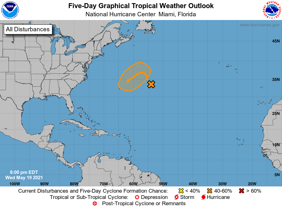
The National Hurricane Center is keeping an eye on an area of disturbed weather in the central Atlantic which has a 40% shot at briefly taking on subtropical characteristics over the next few days. It’s no threat to the US, but could bring some stormy weather to Bermuda. If the storm is named, it would be called Ana, making this the seventh straight May with a preseason named tropical system.
Hurricane season officially starts on June 1.
Follow my Charleston Weather updates on Mastodon, Bluesky, Instagram, Facebook, or directly in a feed reader. Do you like what you see here? Please consider supporting my independent, hype-averse weather journalism and become a supporter on Patreon for a broader look at all things #chswx!