Another day in the 90s to close out the work week
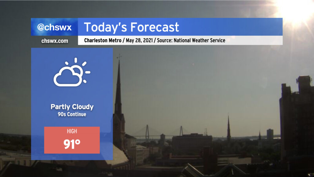
We’ll be back in the 90s today — perhaps for the last day for a little while — as the lingering effects of high pressure aloft remain for one more day before a front moves into the area on Saturday. Unlike yesterday, an earlier seabreeze progression will keep highs capped around 90-91°. (Yesterday’s high was 94°, tying Monday for warmest so far in 2021.) A shower or two can’t be totally ruled out as the seabreeze progresses inland, but with dry air remaining in place for one more day, coverage will be limited.
A comfortably warm Memorial Day weekend lies ahead
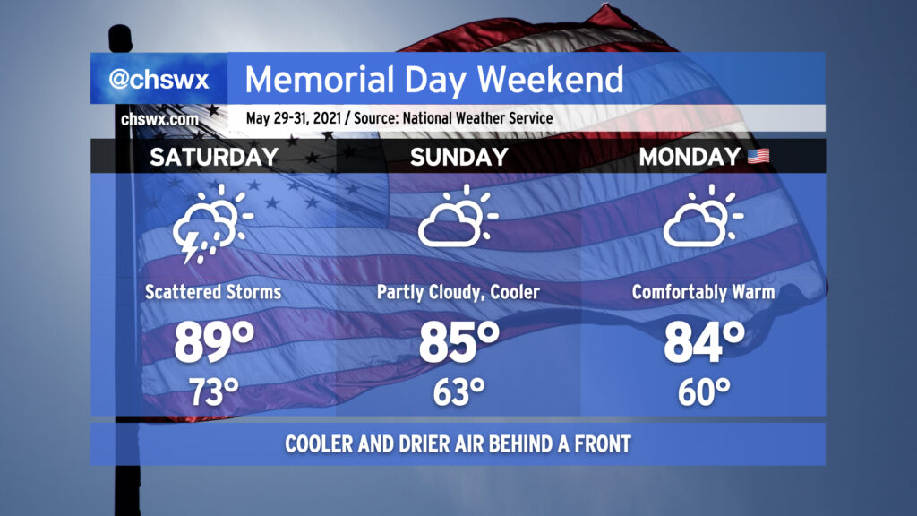
On Saturday, a cold front will backdoor into the area from the north, kicking off more widespread — but still hit-or-miss — coverage of showers and a few thunderstorms than we have seen in recent weeks. Temperatures look to still top out around 90°, but may fall just short depending on when and where showers and storms materialize.
Once the front gets through, cooler-than-normal temperatures will spill into the area, making for a rather comfortably warm rest of the Memorial Day weekend. Dewpoints falling into the 50s will make mid-80s for highs feel good, and we’ll start each morning in the 60s (with maybe even some 50s well inland). Climatologically speaking, this puts this Memorial Day weekend right around average temperatures for the year. (Thankfully, no repeat of Memorial Day 2019, which was the hottest on record!)
Follow my Charleston Weather updates on Mastodon, Bluesky, Instagram, Facebook, or directly in a feed reader. Do you like what you see here? Please consider supporting my independent, hype-averse weather journalism and become a supporter on Patreon for a broader look at all things #chswx!