Tropical update: Zombie Fred approaches the Gulf Coast while Grace follows its lead
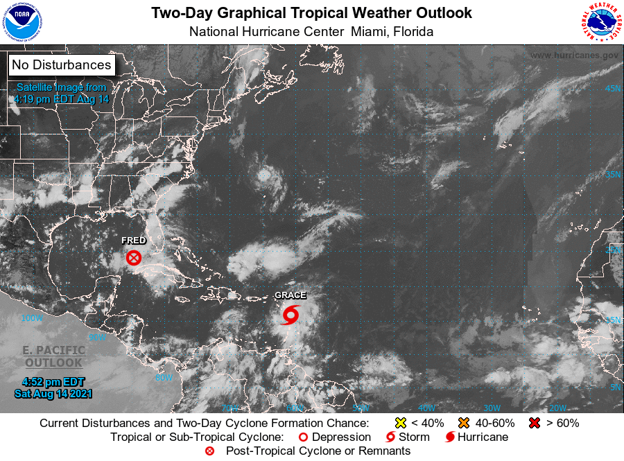
We in #chswx continue to track two tropical systems in the Atlantic basin, Fred and Grace. Fred has opened up into a tropical wave for the time being, and is thus not currently a tropical cyclone, but is expected to reorganize into one and approach the Florida Panhandle as a tropical storm. Grace, meanwhile, is bringing very heavy rain to the Lesser Antilles this evening as it generally follows in Fred’s footsteps. The good news is that there are no immediate tropical threats for the Lowcountry and the rest of the Carolinas.
Fred to bring tropical storm conditions to the Florida Gulf Coast; direct impacts on the Carolinas minimal
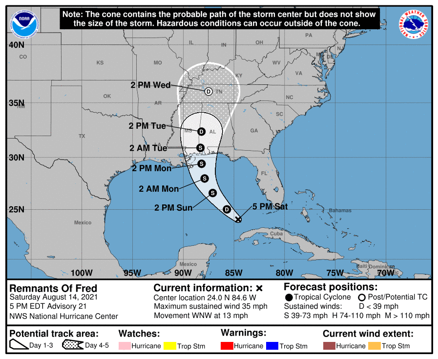
Hispaniola and Cuba proved to be tough opponents for Fred as the landmasses disrupted the circulation enough to open it back up into a tropical wave. Fred’s remnants have since emerged back into the Gulf of Mexico, where it is expected to reorganize its circulation and strengthen back to a tropical storm by tomorrow afternoon. Provided it behaves as forecast, it will approach the Florida and Alabama Gulf Coast during the day Monday, likely making landfall late Monday or early Tuesday as a middle-of-the-road tropical storm.
The center will stay well to the west of the Carolinas, limiting Fred’s influences here considerably. It will help as a vector for drawing tropical moisture northward, though, and with a stalling cold front nearby, we can expect a fair bit of rain over the next few days. The good news is that we do not expect any tropical storm conditions here in the Carolinas.
Much uncertainty ahead with Grace as it follows Fred’s path
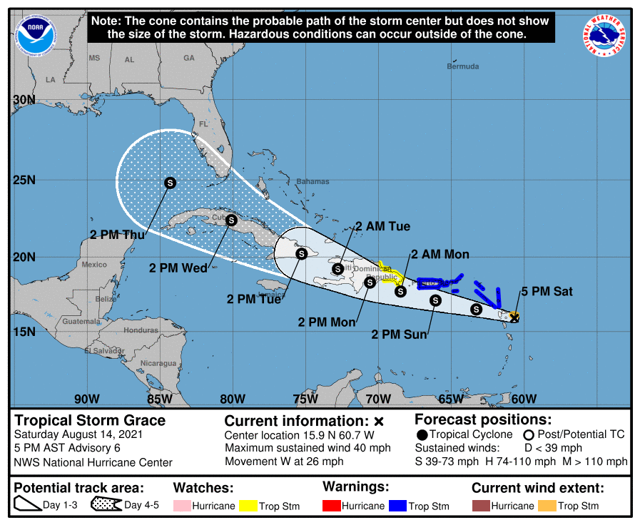
The next storm to watch is Tropical Storm Grace, which is approaching the Lesser Antilles at 26 MPH with maximum winds of 40 MPH. The Hurricane Hunters had a hard time finding a surface circulation with this one according to the 5 PM NHC discussion. It is expected to get more organized, though, as it moves west to west-northwest over the next few days.
Much as we saw with Fred, the big question will be the degree to which Grace interacts with land. Right now, the NHC forecast takes it right across Hispaniola and Cuba, much like Fred did. However, with the iffy surface circulation, it can be tough for models to get a lock. This is reflected pretty well in the guidance spread especially in the longer term, which is pretty much all over the place both for track and, to some extent, intensity.
Given the uncertainty, position in the Atlantic, and the continued establishment of a ridge of high pressure to our north, we will certainly want to watch Grace for any signs of misbehavior. It won’t take much of a jog to get Grace more time over water and, in turn, to strengthen.
Elsewhere, NHC has no other areas of interest for now. We’re getting into the meat of the season, though, and it’s likely only going to get busier from here. Stay tuned…
Follow my Charleston Weather updates on Mastodon, Bluesky, Instagram, Facebook, or directly in a feed reader. Do you like what you see here? Please consider supporting my independent, hype-averse weather journalism and become a supporter on Patreon for a broader look at all things #chswx!