Turning wetter this weekend as the pattern becomes more unsettled
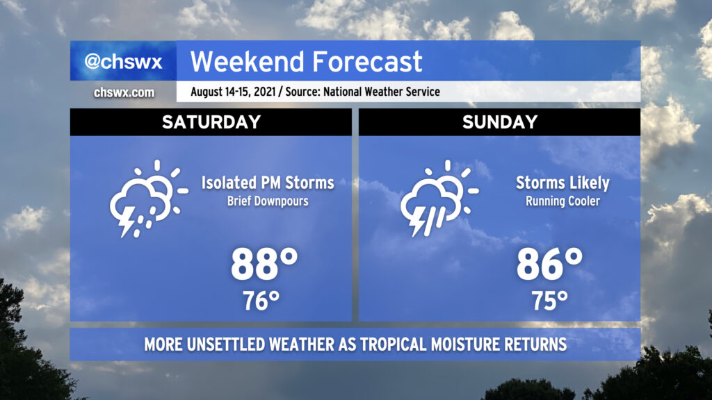
Pro tip: Mow the lawn Saturday morning, because we could start to see some showers and storms enter the picture in the afternoon as high pressure begins to weaken across the area. It’ll still be warm, but temperatures will be limited to the upper 80s by more pervasive cloud cover.
Why mow Saturday? Because Sunday is going to be a lot tougher to get that mowing in, and it doesn’t get better getting into next week. Showers and thunderstorms look to become a little more widespread Sunday, with on-and-off storms possible for a good bit of the day. As usual in summer, it won’t rain all the time, but when it does, a brief downpour or two could drop a decent amount of rain.
As we get into next week, a continued feed of tropical moisture and a stalled front will interact will keep scattered to widespread showers and thunderstorms in the forecast, particularly in the afternoons.
Two storms to watch in the Atlantic as Tropical Depression Seven forms
The tropics are certainly continuing to ramp up in activity. We have been watching Tropical Depression Fred for several days, and now we have Tropical Depression Seven to keep a close eye on as well.
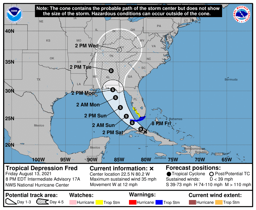
First, let’s talk Fred: Its circulation has been moving over Cuba for much of the day, keeping the storm from strengthening at all. It should emerge off the northern coast of Cuba tonight and strengthen to a Tropical Storm in the Florida Straits. Tropical Storm Warnings are up for the Florida Keys as a result. It should gain a little more strength as it moves northward through the eastern Gulf of Mexico Sunday into Monday, with a forecast landfall point between roughly Mobile, AL and Apalachicola, FL sometime Monday afternoon. As always, this forecast is subject to further refinements. The good news for the Lowcountry is that direct impacts from Fred are not expected, but its plume of tropical moisture will still allow for some periods of heavy rain as it interacts with a stalling cold front.
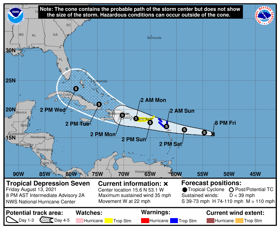
Tropical Depression Seven — expected to become Tropical Storm Grace as soon as late tonight — closed off a circulation today and earned its tropical cyclone designation as a result. It is headed westward, following in Fred’s footsteps, and looks to have a date with Puerto Rico and Hispaniola Sunday into Monday. Much uncertainty follows, with guidance falling into two camps: a stronger Grace taking a more northward tack toward the Bahamas, and a weaker Grace, disrupted by land interaction, staying a little further south. For now, we put it firmly in the “storm to watch” category given its location, forward motion, the prevailing ridge to the north, and the significant uncertainty in the forecast beyond Monday.
Follow my Charleston Weather updates on Mastodon, Bluesky, Instagram, Facebook, or directly in a feed reader. Do you like what you see here? Please consider supporting my independent, hype-averse weather journalism and become a supporter on Patreon for a broader look at all things #chswx!