The week ahead: Late-season afternoon thunderstorm regime returns
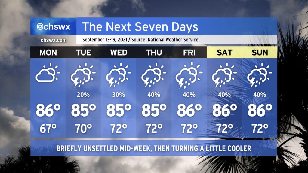
After a really nice weekend across the Lowcountry, we’ll get one more day of low humidity for Monday before high pressure weakens and retreats eastward, bringing back a more summer-like feel to the forecast (sans 90° temperatures, at least). Slight storm chances begin Tuesday afternoon, with more scattered coverage expected each afternoon through the weekend. Temperatures look to remain generally in the mid-to-upper 80s each afternoon, with lows rising into the low to mid-70s starting Tuesday.
Tropical development possible between Bermuda and the Carolinas this week
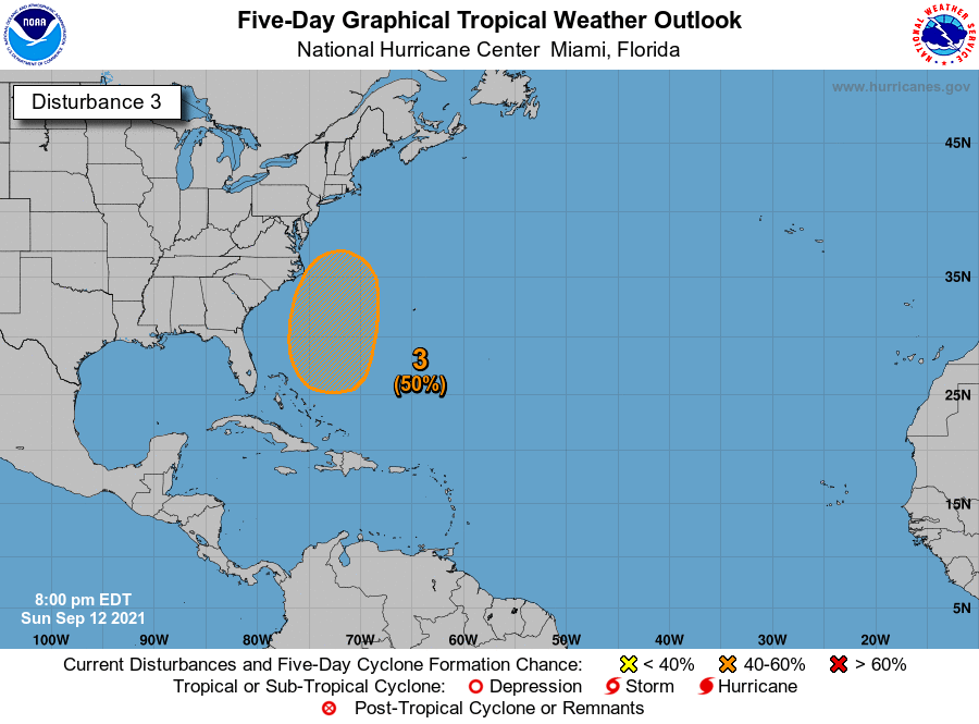
The National Hurricane Center is keeping an eye on an area stretching from the Bahamas to just off the Outer Banks for possible tropical development later this week. Model ensembles have been consistent in a few members signaling low pressure developing between the Carolinas and Bermuda for the past few days. For its part, NHC is giving 50% probabilities for tropical development. Given the close proximity to the Carolinas, we’ll be keeping an eye on this spot, but this isn’t something to be overly concerned about for the Charleston area at this point.
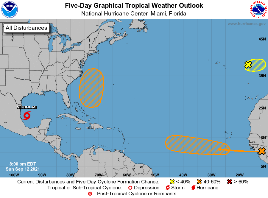
Elsewhere in the tropics, NHC is issuing advisories on Tropical Storm Nicholas, which may bring copious amounts of rainfall to the Texas Gulf Coast over the next few days. They are also watching for a tropical wave to head into the Atlantic tomorrow, and give it a 60% chance of development over the next week as it traverses westward through the Main Development Region of the tropical Atlantic.
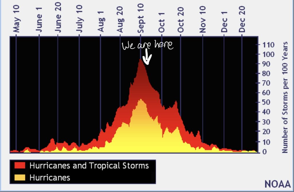
We remain in the peak period of hurricane season. The climatological peak was September 10, but we still have plenty of season to go. With no imminent threats, it’s a good time to make sure your supply kits and storm plans are all up to snuff — it’s much less stressful to do so now than when a storm is bearing down, after all.