One more day in the 70s on Tuesday before we cool off
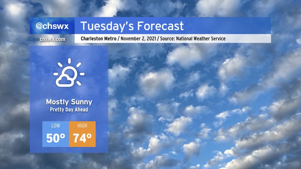
We’ve got one more really nice day on Tuesday before temperatures begin to fall back off into sweater weather territory. (Not that there’s anything wrong with that.) Expect highs to top out in the mid-70s after starting around 50° in the morning with mostly sunny skies throughout. We’ll begin to cool off after Tuesday as high pressure wedges southward into the area; highs don’t get out of the 60s on Wednesday and Thursday, and might not even crack 60° on Friday.
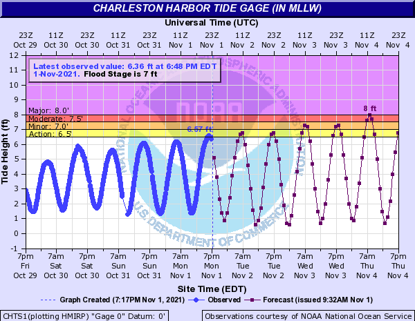
As high pressure wedges southward, winds will turn northeasterly and a bit more breezy to boot. This happens in conjunction with the new moon making its closest approach (perigee). Thus, the risk for coastal flooding increases markedly starting Wednesday morning. We’ll likely see coastal flooding at times of high tide into the weekend. The time period to watch is Thursday morning’s high tide, which could reach 8’ in the harbor right in the heart of the morning commute. This is major flood stage; it’s here where we really see widespread road closures and issues not only downtown but also around James Island and the coastal communities. We’ll want to watch this very closely for significant travel disruptions later this week. Stay tuned.
Follow my Charleston Weather updates on Mastodon, Bluesky, Instagram, Facebook, or directly in a feed reader. Do you like what you see here? Please consider supporting my independent, hype-averse weather journalism and become a supporter on Patreon for a broader look at all things #chswx!