Friday & the weekend: Chilly start, then 70s briefly reappear
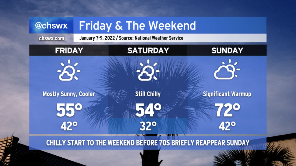
After a couple slightly warmer days, a reinforcing shot of cooler air arrives for Friday into Saturday. Highs will once again top out in the mid-50s both days despite plenty of sunshine. A freeze is even likely for most of us away from the coast on Saturday morning, too. By Sunday, though, high pressure quickly slips offshore and the southerly return flow turns the heat pump back on, sending us into the low 70s in the afternoon ahead of an advancing cold front. There could be some shower chances late Sunday, but the best risk of rain right now appears to be overnight Sunday into Monday morning as the front swings through. All in all, not a bad-looking weekend with a little something for both cool-weather and warm-weather fans.
Additionally, tomorrow should be only the second time this year that we will not have any coastal flooding concerns in Charleston Harbor. Water levels once again peaked just over 7′ this morning, making it 5 of 6 days so far in 2022 with some tidal flooding to contend with. (The one day there was no flooding? Monday, when the windstorm blew the tide out well below predicted levels.)