The week ahead: Below-normal temperatures with a particularly wintry chill for mid-week
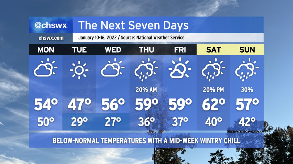
We’ll see some showers and thunderstorms overnight as a cold front approaches the area. No severe weather is expected, but some gusty winds and brief heavy downpours are possible as the line gets through. Rain should clear the area before daybreak.
Once the front is through, temperatures will plummet and clouds will scour out. Expect high temperatures to only top out around the mid-50s with some afternoon sunshine. Then, we’ll have a pretty cold night overnight Monday into Tuesday morning, with lows getting into the upper 20s in the metro area away from the coast. Highs on Tuesday will only top out in the upper 40s despite full sunshine.
After another somewhat hard freeze Wednesday morning, temperatures will begin to moderate some as an upper disturbance approaches from the west and high pressure slips offshore. We might see a few showers Thursday morning as the disturbance swings through, but will close the work week with mostly sunny skies. Showers re-enter the realm of possibilities for the weekend as another front approaches the area. Temperatures will remain generally around if not a click or two below normal.