Rest of the work week: Temperature rollercoaster rolls on as we watch another winter weather threat

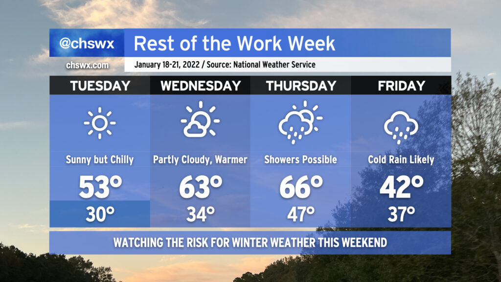
The temperature rollercoaster will continue as we head into the rest of this abbreviated (for some, anyway) work week. Tuesday will be sunny but still quite chilly as the cold airmass that this weekend’s storm ushered in stays put for another day. High pressure slips offshore Wednesday, though, allowing temperatures to warm up into the low 60s in the afternoon with a little bit more cloud cover working its way in ahead of a cold front. That front will get a little closer on Thursday and could begin to spread some showers into the area into the afternoon hours, but should stay far enough west to keep us in the 60s one more day.
Then Friday rolls around, and the wheels come off in terms of forecast confidence. What is probable is that the front will keep some precipitation around on Friday, and temperatures will be significantly cooler behind said front. The NWS forecast highlights rain showers and highs in the low 40s for Friday as cold high pressure wedges southward. Beyond that, the forecast turns very tricky. Weather models continue to disagree on many of the details of what to expect this weekend, but the potential for at least a little winter weather is increasing. The GFS model has a double-barreled shot of mixed precipitation for Friday night and again over the weekend as it has low pressure developing near the coast and moving northeastward. The ECMWF (Euro) operational model generally shows the primary winter weather threat in the form of freezing rain on Friday night into Saturday followed by dry weather the rest of the weekend.
Suffice to say, it’s a tricky, tricky forecast with more questions than answers at the moment. There are many scenarios, including an all-rain scenario, that are very much on the table. I urge you to continue to monitor forecast updates throughout the week as the details continue to come together, especially with the potential for freezing rain to develop.