Turning warmer for Wednesday as we keep an eye on potential for freezing rain Friday
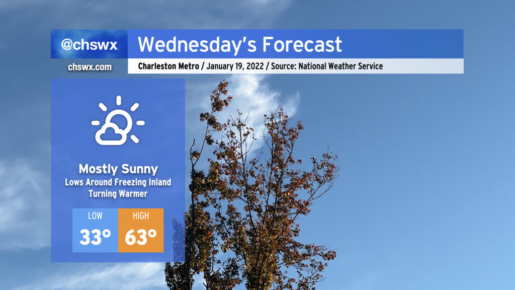
Wednesday’s weather looks pretty good. Temperatures will start out right around freezing — be sure pets and plants are protected once again tonight — with a nice warming trend up to the low 60s as high pressure slips offshore. All this will be under mostly sunny skies, with a few more clouds today than yesterday.
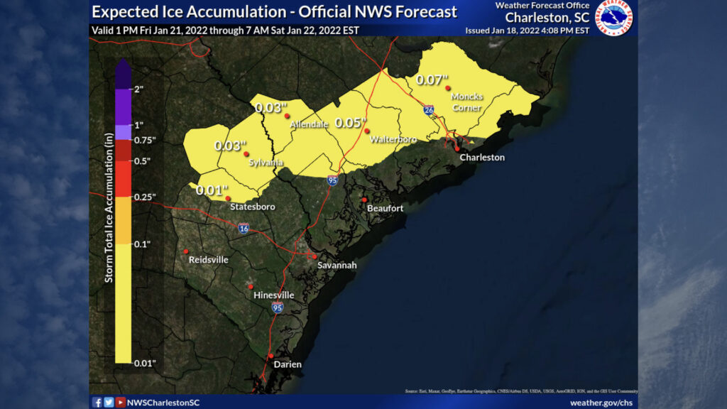
The weather respite is helpful as we continue to pay very close attention to the potential for freezing rain Friday night into possibly Saturday morning. Confidence in freezing rain has increased as models have gotten a bit more aligned on the expected precipitation type Friday evening through Saturday morning. What remains in question is just how much will fall and how long it will fall, and that’s where there remains some disagreement. NWS’s first call is generally for a light glaze under a tenth of an inch generally north of Charleston proper. This would include many suburbs including Summerville, Goose Creek, and Moncks Corner. With that being said, this is a first call, and as confidence grows, there will almost certainly be revisions to this map.
In the meantime, be preparing for the potential for scattered power outages and difficult travel Friday night into Saturday morning, especially inland of 17-A. Keep abreast of forecast updates over the next couple days as the event gets more into focus.
Follow my Charleston Weather updates on Mastodon, Bluesky, Instagram, Facebook, or directly in a feed reader. Do you like what you see here? Please consider supporting my independent, hype-averse weather journalism and become a supporter on Patreon for a broader look at all things #chswx!