Thursday: Turning unsettled ahead of the cold front
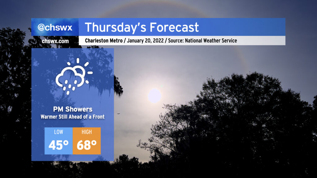
It’s going to be hard to believe that we’ll go from near 70° during the day Thursday to a winter storm come Friday, but that’s what’s going to happen. We’ll spend one last day in the warm sector as the cold front steadily pushes eastward; by afternoon, we should begin to see some showers work their way into the area ahead of said front. Rain will turn more likely as we get into the evening hours, so be ready for a wet commute home from work.
Winter Storm Watch in effect for Friday evening into Saturday morning
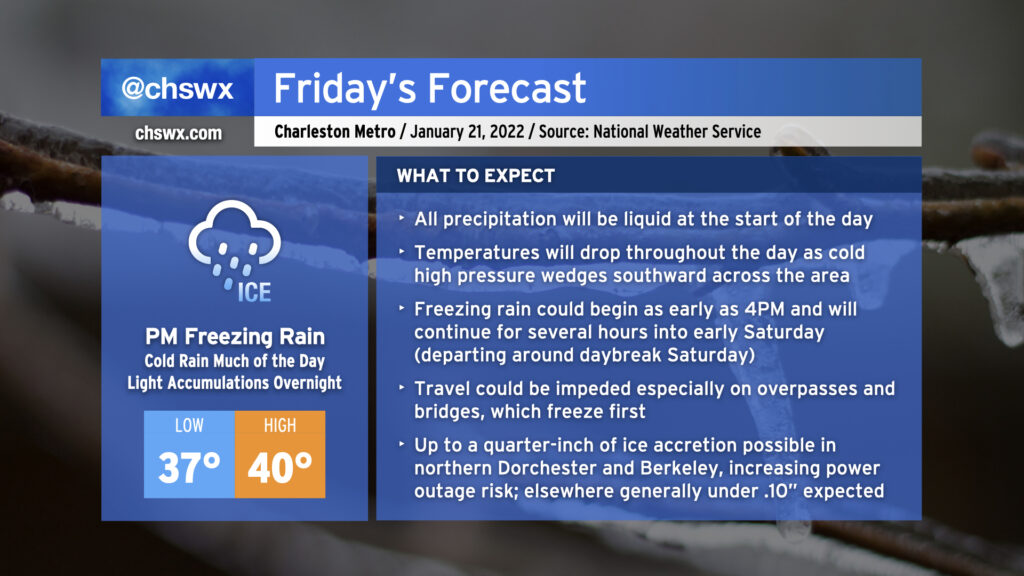
The cold front should be through the area by daybreak on Friday. From there, very chilly high pressure will wedge in from the north, and temperatures will steadily decrease throughout the day as showers are ongoing. We could see temperatures fall below freezing as early as 4PM, which will usher in the risk for freezing rain. Expect light freezing rain generally through early Saturday morning; most models have it out of here by daybreak. To account for this, the National Weather Service has a Winter Storm Watch out valid 4PM Friday to 10AM Saturday. This could be upgraded to a Winter Weather Advisory or even an Ice Storm Warning for some folks depending on forecast trends.
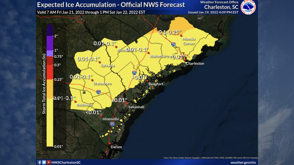
Ice accretion looks to be fairly minimal near the coast with a light glaze of ice on elevated surfaces being possible. Move into the 17-A corridor, and you may be looking at up to around a tenth of an inch of ice — enough to start to cause travel issues and isolated power outages. Head further into northern Berkeley and Dorchester counties and you may encounter more substantial icing on the order of .10″-.25″. At a quarter of an inch of ice, this is where we begin to see more in the way of power and travel issues. Winds gusting to 20-25 MPH may be enough to bring some ice-laden trees down, too.
Even though the ice forecast is generally light especially in the coastal areas, remember that bridges and overpasses will freeze over first, and it may not take much to get those slickened up. This risk only increases as you head further inland along I-26 or US Highway 52. Bottom line: Friday night is going to be one of those nights where you are just going to want to stay in, make dinner at home, and just hunker with a book or a movie or three. Keep devices charged in case you lose power, and make sure your pets have a warm place to be. (It’ll be a cold weekend in general, with lows in the 20s Saturday and Sunday and highs not making it out of the 40s.)
Stay tuned to additional forecast updates as these totals are further refined. We’re now well into the period where the high-resolution models will be able to resolve some of the finer details, so expect some tuning and tweaking over the next day.
Follow my Charleston Weather updates on Mastodon, Bluesky, Instagram, Facebook, or directly in a feed reader. Do you like what you see here? Please consider supporting my independent, hype-averse weather journalism and become a supporter on Patreon for a broader look at all things #chswx!