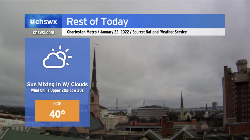
Cloud cover will continue to break up as the day goes on, and yes, most of you should see at least some periods of sunshine before the day is out. Temperatures, however, will struggle to around 40° as much of that energy goes to melting ice and sleet accumulations. Winds out of the north will still be a bit brisk, with wind chills dropping into the upper 20s to low 30s at times.
Roads will continue to improve throughout the day, but traveling is still probably unwise until mid-afternoon at least as there are still reports of troublesome bridges and overpasses.
We’ll want to see the degree of melting and drying that can happen today into tonight. We’re looking at the coldest night of the season so far tonight into tomorrow morning, so the risk for black ice redeveloping is something we will want to keep an eye on as we head into Sunday.
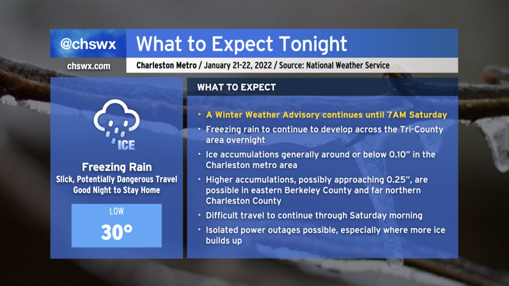
Freezing rain will continue overnight into early Saturday morning as moisture streams across the area from the southwest and a shallow layer of cold air continues to wedge southward into the area. As of this writing, temperatures are at freezing at all stations inland of the immediate coast, with reports of ice covering vehicles, elevated surfaces, and grassy surfaces starting to come in throughout the Tri-County.
Rain will continue to fall overnight, and as a result will continue to freeze on contact. At this point, it’s best to be where you’re going to be until tomorrow morning as ice buildup will continue. Most spots should see at or below a tenth of an inch of ice accretion before it’s all said and done; however, high-resolution guidance continues to suggest a little bit more accretion, possibly approaching 0.25″ in spots, in eastern Berkeley County and far northern Charleston County.
Travel will become increasingly difficult tonight, and the risk for isolated power outages will continue. Keep a flashlight nearby and your phones charged just in case.
Freezing rain is expected to be out of here by daybreak Saturday. Slick spots could persist into the late morning and early afternoon, though, as temperatures slowly warm to the low 40s with gradually decreasing cloud cover.
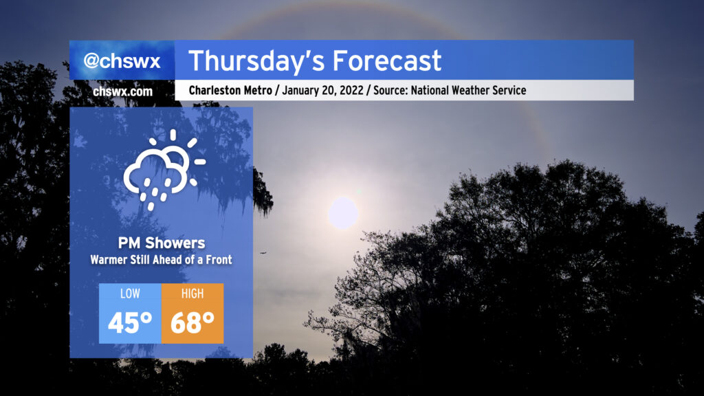
Here’s a little weather whiplash for you: We got to 73° today at the airport. Tomorrow, we won’t even reach 40°.
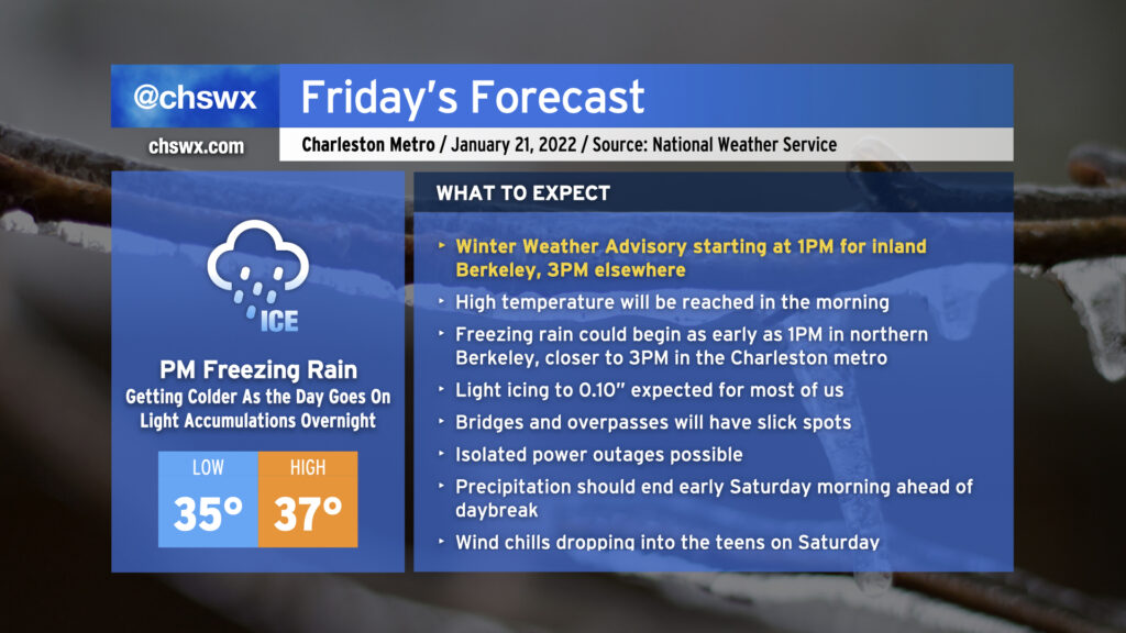
A cold front is sinking steadily southward in our direction this evening, which will allow a wedge of Arctic high pressure to steadily build in from the north as we get into Friday. We’ll start the day in the mid-30s, warm up to the upper 30s, and then temperatures fall below freezing in the afternoon, all while light rain blankets the area. As the freezing line moves southward, so will the changeover to freezing rain, generally on elevated surfaces (including bridges and overpasses.) This freezing rain threat will arrive by Friday evening and stick around through early Saturday before low pressure departs and brings the stalled front with it.
It’s going to be hard to believe that we’ll go from near 70° during the day Thursday to a winter storm come Friday, but that’s what’s going to happen. We’ll spend one last day in the warm sector as the cold front steadily pushes eastward; by afternoon, we should begin to see some showers work their way into the area ahead of said front. Rain will turn more likely as we get into the evening hours, so be ready for a wet commute home from work.
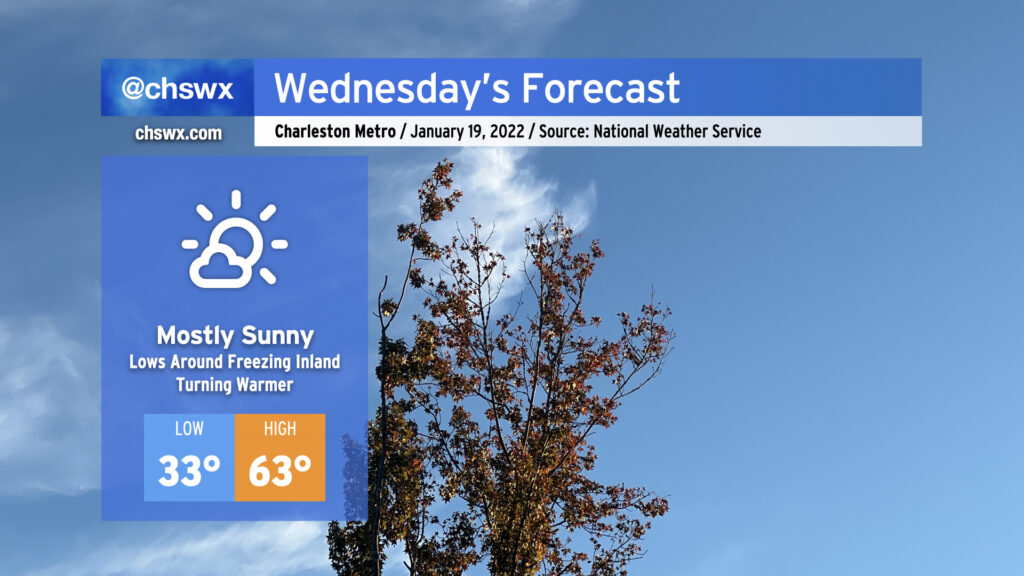
Wednesday’s weather looks pretty good. Temperatures will start out right around freezing — be sure pets and plants are protected once again tonight — with a nice warming trend up to the low 60s as high pressure slips offshore. All this will be under mostly sunny skies, with a few more clouds today than yesterday.