Freezing rain to continue overnight
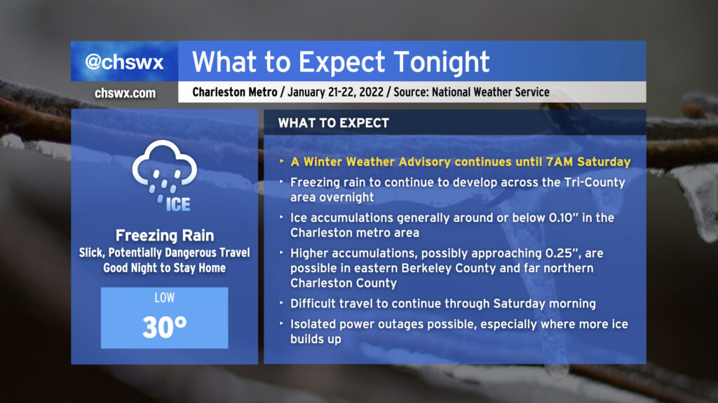
Freezing rain will continue overnight into early Saturday morning as moisture streams across the area from the southwest and a shallow layer of cold air continues to wedge southward into the area. As of this writing, temperatures are at freezing at all stations inland of the immediate coast, with reports of ice covering vehicles, elevated surfaces, and grassy surfaces starting to come in throughout the Tri-County.
Rain will continue to fall overnight, and as a result will continue to freeze on contact. At this point, it’s best to be where you’re going to be until tomorrow morning as ice buildup will continue. Most spots should see at or below a tenth of an inch of ice accretion before it’s all said and done; however, high-resolution guidance continues to suggest a little bit more accretion, possibly approaching 0.25″ in spots, in eastern Berkeley County and far northern Charleston County.
Travel will become increasingly difficult tonight, and the risk for isolated power outages will continue. Keep a flashlight nearby and your phones charged just in case.
Freezing rain is expected to be out of here by daybreak Saturday. Slick spots could persist into the late morning and early afternoon, though, as temperatures slowly warm to the low 40s with gradually decreasing cloud cover.
Be safe and warm tonight!