Record highs to be threatened again Thursday and Friday, but cooler weather is coming
Wednesday was a very unusually warm February day in the Lowcountry. The high of 86° handily obliterates the daily record for February 23 of 82° set in 2018, but today also marked just the fourth time since records began in 1938 that the high temperature reached 86° in February. Previously, this happened on February 25, 2018, February 16, 1989 (when the high was 87°, setting the all-time February record), and February 28, 1962.
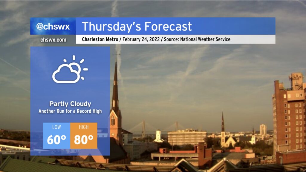
We look to take another trip into the 80s tomorrow. While surface flow coming a touch more off the Atlantic may modulate temperatures a bit, it is still certainly possible we may at least tie the daily record of 83° set in 2018. Fog may be a greater issue tonight and tomorrow morning, though, with lighter winds making for more favorable conditions for fog development. This fog could be dense, so be ready for visibility restrictions as you commute Thursday morning. The slightly more onshore trajectory could also help spread sea fog inland later in the day, which would have a chilling effect on temperatures as well. As usual with our weather, there’s so many variables to watch, even when there’s no precipitation involved. But regardless, prepare for another absurdly warmer-than-normal February day.
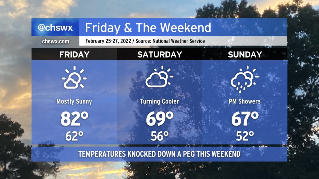
This round of #FakeSpring continues into Friday before a dry cold front swings through Friday night and takes temperatures down a peg heading into the weekend. Saturday looks to remain rain-free, but there are signs that a few showers will be possible on Sunday with a little more moisture in the area. We turn even cooler as we get into the next work week, but let’s not think of unpleasant things such as “the next work week” right now. 🙂