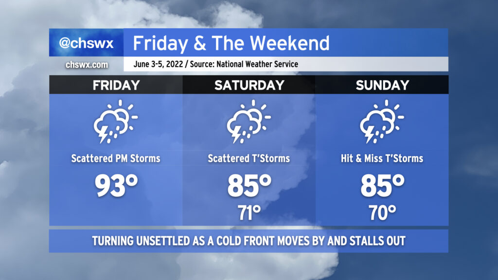
Today & the weekend: Turning unsettled but cooler

We have one more fairly hot day in store before a cold front moves into the area later tonight, bringing with it some unsettled weather — perhaps a strong thunderstorm or two — before moving through and stalling out to our southeast, keeping rain chances in play for the weekend (though turning a little better by Sunday).
Today will start as the past few days have, with temperatures heading into the 90s by early afternoon. Around 2-3 PM, we should start to see showers and thunderstorms fire on the seabreeze — perhaps as close to the coast as the US-17 corridor — before gradually moving inland with time. At the same time, we’ll be watching the cold front to our north and west continue to press into the Carolinas. With the seabreeze, other colliding outflow boundaries, and the approaching front, a couple storms could turn strong to severe, particularly inland. Damaging wind gusts are the primary concern.
The convection-allowing models hint at a lull in the activity this evening before the front gets through the area, perhaps spreading some showers and a few thunderstorms into the area after midnight. Once the front gets through, we will feel somewhat cooler temperatures for the weekend courtesy of winds turning east and northeast as high pressure wedges in from the north. Winds could be a little breezy thanks to a pressure gradient between the aforementioned high pressure and what is expected to be Tropical Storm Alex as it passes well to our south. Alex could also help bring some additional moisture into the area particularly on Saturday, which will keep shower and thunderstorm chances elevated throughout the day (though the highest in the afternoon with daytime heating). By Sunday, the atmosphere dries out a little, but a few hit or miss showers and thunderstorms remain possible into the early evening.
Bottom line for your weekend: It won’t rain all day at any one particular location, but have that rain plan ready to go for any outdoor activities, particularly on Saturday when the probability of precipitation is higher. (And enjoy the cooler temperatures!)