The week ahead: Starting a little cooler, then back to the 90s
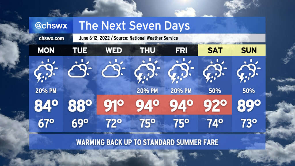
Overall, we’ve got a pretty standard June week ahead in the Lowcountry, with temperatures turning warmer as the week progresses. We’ll go from the mid-80s on Monday to the mid-90s by Thursday and Friday ahead of a cold front that will approach the area for the weekend.
We’ll have the customary summertime slight shower and thunderstorm chance most afternoons (though Tuesday and Wednesday look more likely to stay dry than not). As we head toward the weekend, though, we’ll be watching the aforementioned front and a sharpening trough aloft for an uptick in shower and thunderstorm chances perhaps as early as Friday, but more likely as we get into the weekend. As is customary in June, showers and thunderstorms will be on-and-off, primarily concentrated in the afternoon, and not a total loss of a day as a result. (And yes, it’s too soon to say just how much of an impact we’ll see on the Spoleto finale at Firefly.) Just make sure outdoor activities have backup indoor plans in case showers and thunderstorms approach. While severe weather doesn’t look terribly likely, lightning makes every thunderstorm dangerous. When thunder roars, go indoors!