Warming trend begins Tuesday as we head toward the 90s by the end of the week
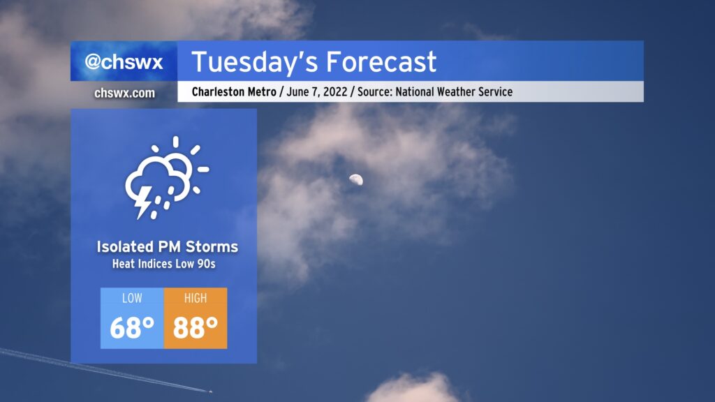
After what was a rather pleasant day today, summer warmth returns to the weather picture beginning Tuesday. Temperatures will top out in the upper 80s in the afternoon, with heat indices running in the low 90s. An isolated storm or two can’t be ruled out, but the majority of us get the day in rain-free.
Rest of the work week: Turning hotter, with heat indices possibly exceeding 100°
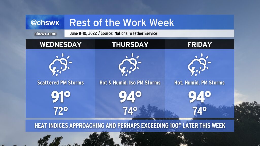
Temperatures will really begin to warm back up as we head toward the latter part of the work week. Humidity will be coming along for the ride, too, making the mid-90s air temperatures feel closer to the low-to-mid-100s. (The NWS Charleston heat advisory criteria before July 1 is heat indices of 105°, BTW.)
Showers and thunderstorms will be possible to varying degrees each afternoon, with the best chance looking like Wednesday so far as upper-level disturbances move by. A cold front will be getting closer on Friday, which will elevate storm chances that evening, too. Said front could help keep things unsettled heading into the weekend, too — something we’ll watch closely as we look toward the Spoleto finale.