Rest of the work week: Back to the 90s with a few storms possible
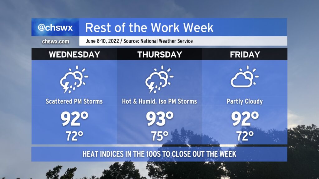
Everyone break out the fanny packs…the 90s are back! We’ll get back there tomorrow afternoon with an uptick in moisture as well; before thunderstorms develop along the seabreeze in the afternoon, we’ll see heat indices approach 100°. We could very well breach the century mark Thursday afternoon, too. Ever-so-slightly drier air might keep heat indices a little more in check on Friday based on this evening’s guidance, but we’ll see how that ultimately goes based on the positioning of a stalling front.
Wednesday and Thursday will both generally feature the standard round of afternoon showers and thunderstorms, aided a bit by some upper-level help. We could even see some additional thunderstorms move into the area Wednesday evening as a disturbance moves by. A couple of Wednesday’s thunderstorms could be on the strong side, too, with damaging wind gusts and large hail the main concerns. Right now, Friday is looking a bit drier, but that will be governed by how far south high pressure can wedge into the area. Stay tuned for fine-tuning on that one.
As we head into the weekend, we could see another round of active weather on Saturday as another front heads into the area. This will be the best chance of rain for the next few days as high pressure builds back into the area on Sunday. Drier air moving in will make for a reasonably nice day on Sunday (though highs look to still top out around 90°), but more importantly, it increasingly looks to be a rain-free day, which is excellent news for the Spoleto finale.