Hot day Thursday, but a little drier air over the weekend keeps heat indices in check
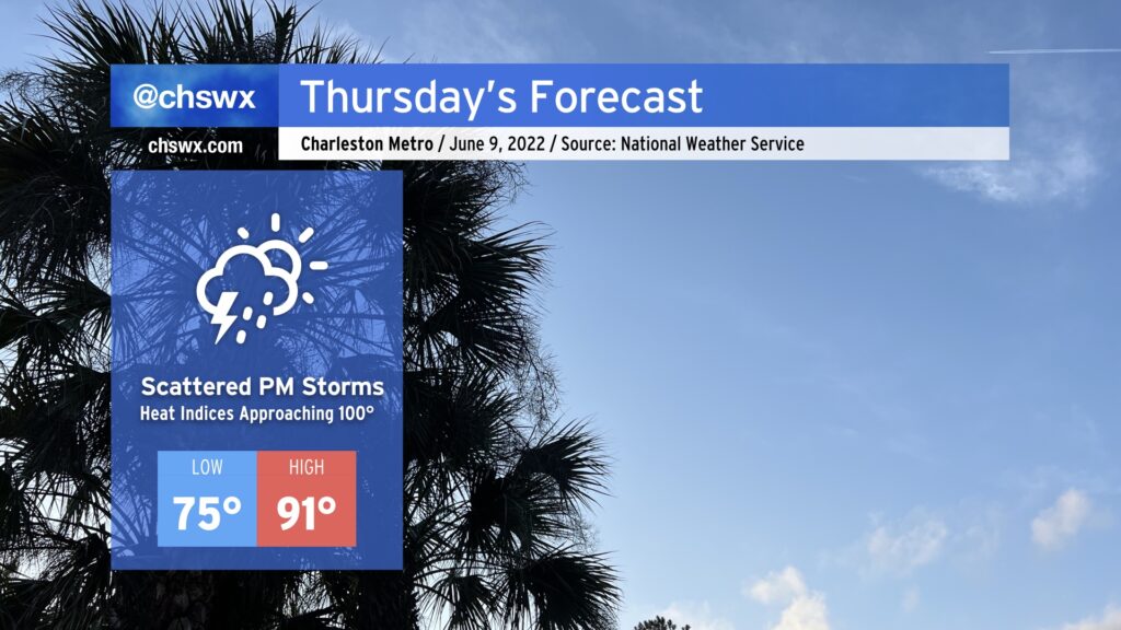
Despite the air temperature topping out around 91°, Thursday’s going to be the hottest day of the week because of quite a bit of humidity. Heat indices could approach 100° in the afternoon before scattered thunderstorms develop along the inland-moving seabreeze. A storm or two could be on the strong side where outflow boundaries intersect, but as is typical in the summertime, any severe weather will be quite localized. Heat will certainly affect everyone, though, so be sure that you’re getting plenty of water and shade if you’re outdoors in the height of the afternoon.
Friday & the weekend: Looking hotter
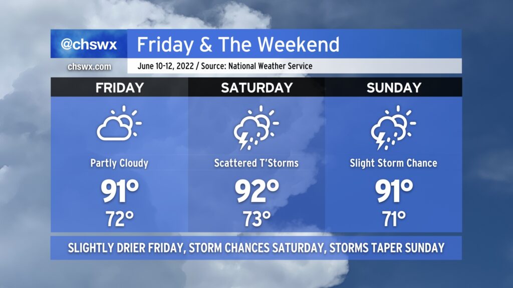
Yesterday, the operational guidance suite gave us some hope that a backdoor cold front would sink far enough southward into the metro area to spread some cooler, drier air into the area especially for Sunday. Unfortunately, that doesn’t seem like it’ll come to pass. We’ll still see a frontal passage late Thursday/early Friday that will usher in a drier airmass. This will help keep heat indices from getting too far out of hand, but we’ll still be dealing with air temperatures in the low 90s each afternoon.
Storm-wise, Saturday looks to be the busier day as a low pressure system approaches the area. That, along with the typical mesoscale features such as the seabreeze and other boundaries, should help scatter showers and thunderstorms across the area in the afternoon and evening. Storms could persist overnight into early Sunday morning. By Sunday, the global models are trending a bit drier, but a stray shower or storm can’t be ruled out in the afternoon. (And yes, despite the warmer and more humid weather in Sunday’s forecast, I still think we’re all good for Spoleto’s finale.)
As we get into the following work week, a “death ridge” of upper-level high pressure will build out to our west. (It’s called this because it essentially puts an end to the spring storm chasing season across the Plains.) This will turn the flow aloft more northwest, and the resulting compressional heating from deep downslope flow will aid in another round of rather hot temperatures, with mid-to-upper 90s certainly on the table as we get into midweek. Stay tuned as details become more apparent — looks like we’re gonna toast again, and our only hope for any relief will come in the form of mesoscale convective systems embedded within the aforementioned northwest flow. (Woof.)