Rest of the work week: Staying hot
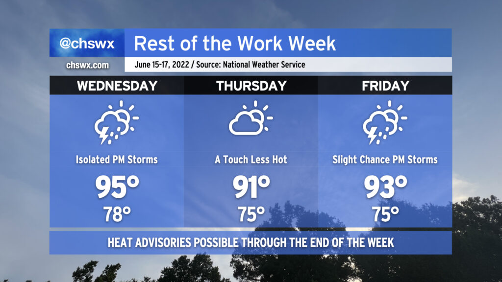
The rest of the work week will remain hot — though not to the degree that we observed today, with the first 98° reading at the airport since August of 2019 — with only a slight chance of a thunderstorm as a strong ridge remains firmly in place across the area. Heat indices could once again reach advisory criteria tomorrow with only a slight chance of a thunderstorm to cool things off. So it will go Thursday and Friday, too, though onshore flow behind a backdoor front will keep temperatures a little “cooler” on Thursday, topping out “only” in the low 90s. Bottom line: Stay geared up for hot weather for the foreseeable future. We’ve got a little break coming Sunday, but the heat will then just surge right back as we get into next week. (Such is summer.)
Coastal flooding will continue to be an issue with the evening high tides through Friday. Onshore flow should send tidal departures even higher on Wednesday evening, with moderate flooding expected with the 9:55 PM high tide. Expect scattered to potentially numerous road closures in downtown Charleston tomorrow evening as a result, though thankfully after the commute.