Rest of the work week: Peak warmth as we reach the hump; storm chances return
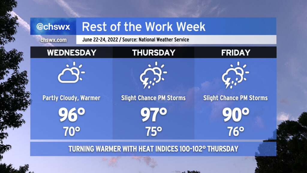
After today came in cooler than expected thanks to some cloud cover (and even a few light showers), the heat should begin to really kick back in on Wednesday as we’ll see much more sunshine than we did today. The atmosphere remains dry and capped, and that will keep afternoon shower and thunderstorm chances at bay for one more day. 70s dewpoints return in earnest for Thursday, and that combined with a 97° air temperature will drive heat indices into the lower 100s in the afternoon. We’ll also start to see the standard slight chance of afternoon thunderstorms return to the forecast Thursday. A weak front will head south across the area late Thursday into Friday, taking the edge off the higher heat for Friday with highs topping out around 90°. We’ll keep a slight chance of seabreeze storms in the forecast to close out the week.