One more hot day Thursday before temperatures return to normal for the weekend
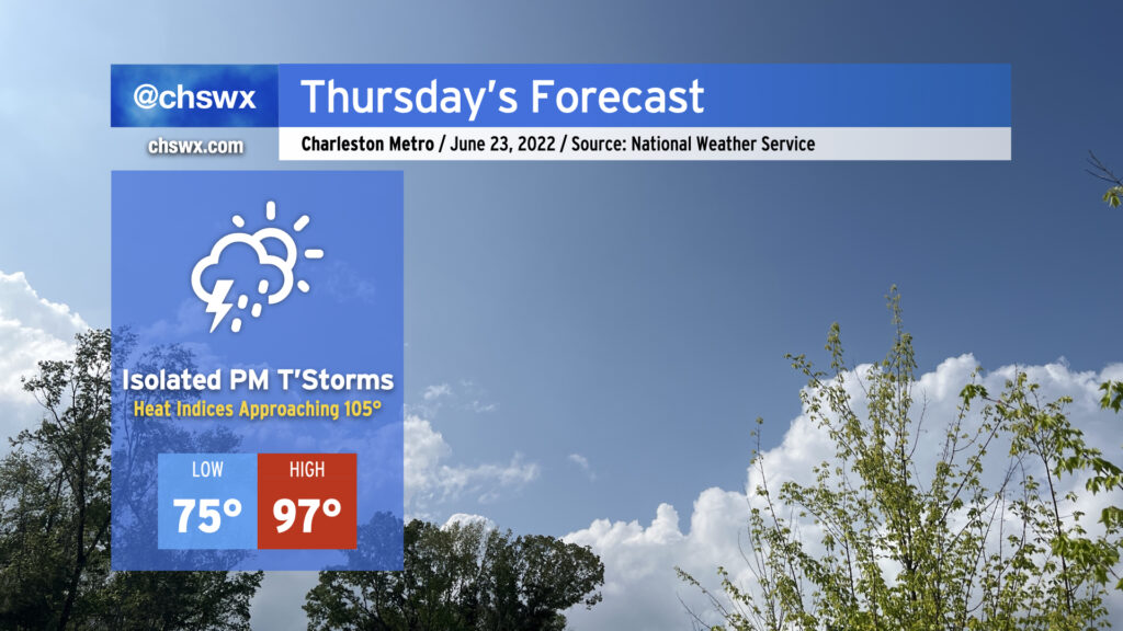
Thursday will be the hottest day this week as air temperatures return to the mid-to-upper 90s across the Lowcountry in the afternoon. Unfortunately, dewpoints will also have recovered back into the 70s, and that could put us close to heat advisory territory for Thursday afternoon as heat indices could approach 105°. There will, however, be a shot at some isolated thunderstorms later in the afternoon into the evening hours as the seabreeze makes its move inland. Lightning and gusty winds will be the primary concern from any thunderstorm that forms, but so far widespread severe weather doesn’t look likely.
Friday & the weekend: Temperatures fall back to normal
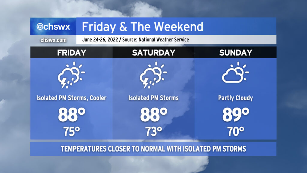
A weak front will sag south across the area on Friday before dissipating. This will help turn winds onshore, which in turn will help keep temperatures closer to mid-to-late-June normals (generally around 90°). Isolated showers and thunderstorms will be possible Friday with the cold front and again on Saturday with the seabreeze, and I wouldn’t totally count one or two out for Sunday, either, though we’ll have a little less humidity to deal with. Temperatures look to remain within a degree or two of normal in either direction as we get into the meat of next week as the pattern turns a little more unsettled. We could still very much use the rain!