Independence Day: Hot, humid, scattered thunderstorms
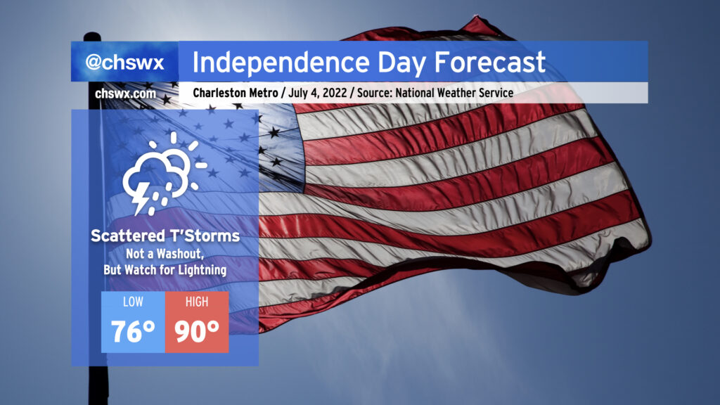
As is customary for the Lowcountry, heat and humidity will feature prominently in the Independence Day forecast, with some scattered afternoon and evening thunderstorms to cool some of us off. Before thunderstorms fire, we should see temperatures reach into the upper 80s to low 90s away from the somewhat cooler (but still quite humid) coastline. This warmth when combined with mid-70s dewpoints will yield heat indices in the low 100s for tomorrow. Be sure to get plenty of water and shady breaks if you’re outside for an extended period. (Don’t forget the sunscreen, either.)
By 1-2 PM, we should begin to see some showers and thunderstorms start to initiate along and inland of the seabreeze circulation. We’ll want to watch the 1-4PM period closely for the greatest risk for lightning to the beaches as there will be more than ample instability for strong updrafts to develop. (Remember: When thunder roars, go indoors!) Places that get caught under a thunderstorm will not see it move too terribly much during its lifecycle; with precipitable water values at or exceeding 2″, we could see some pockets of rather heavy rain in a short time in some spots. Wind shear is nearly nonexistent, so severe weather looks quite unlikely outside of the potential for a wet microburst somewhere. Severe potential aside, lightning makes all thunderstorms dangerous, so please do move indoors if you see lightning or hear thunder.
The good news, though, is that the Fourth of July will not be a complete washout. We should see storms begin to clear the Tri-County by early evening as the seabreeze progresses inland, and fireworks shows should be very much go for liftoff. Have a safe and fun holiday!