Sunday: Storms becoming numerous by afternoon, heavy rain and minor flooding possible
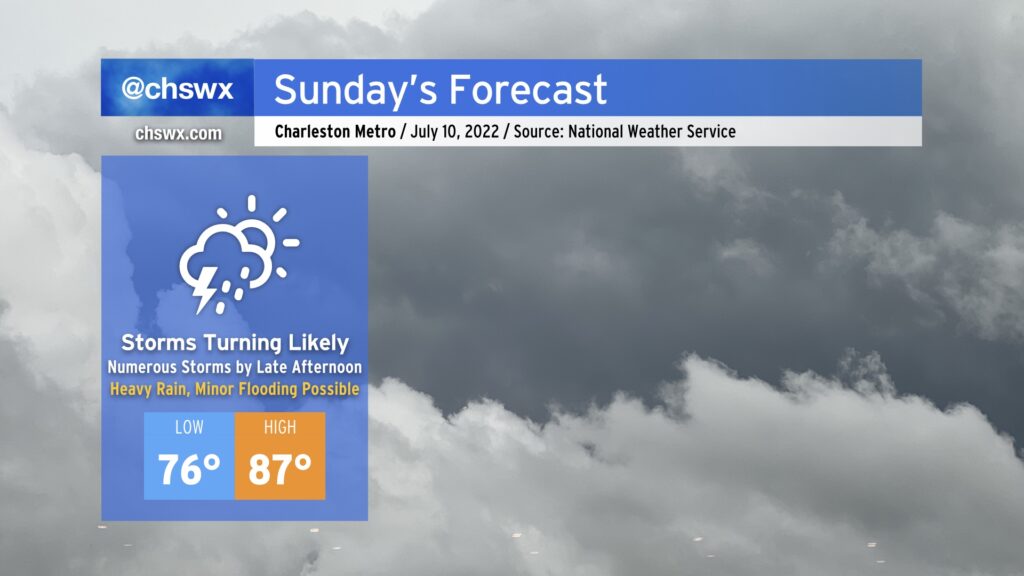
Another round of soaking, heavy rain is expected on Sunday as a front sinks into the area and stalls out. There will be a chance of rain for much of the day, but the best risk of rain will arrive in the afternoon and evening hours as thunderstorms look to erupt near the frontal zone as well as on other boundaries. Thunderstorms will be capable of very heavy rain and a good bit of lightning. Minor flooding will be a concern given 2.3-2.4” precipitable water values — atmospheric moisture that’s very much on the top end of what we’d see this time of year. We’ll also want to watch closely around the time of the evening high tide (5:48 PM) for the potential for heavy rain and said tide to coincide, perhaps increasing the flood threat for downtown Charleston in particular. An isolated wet downburst could pose an issue as well, but the overall severe threat will be limited.
We should see temperatures run up to the mid-80s before storms fire; this, combined with mid-to-upper 70s dewpoints will yield heat indices around 100° in the afternoon.
Stay alert for rapidly changing conditions tomorrow, and be ready to find alternate routes in case you encounter flooded roadways!