Today & the weekend: Off and on storms to continue with heavy downpours
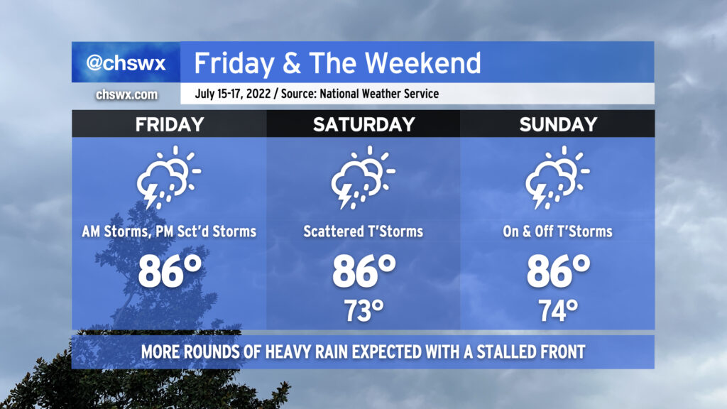
After an absolute deluge last night, with some weather stations in the Summerville, Ladson, and Hanahan areas reporting upwards of 5-8+” of rain and reports of numerous roads and even some properties seeing flooding, we will continue with the risk for showers and thunderstorms for today into the weekend. Temperatures will be held into the mid-80s given cloud cover and nearby thunderstorm activity, which will be possible pretty much at any point throughout the day but particularly in the afternoon hours. It’s worth noting that it won’t rain all the time, either. We’ll undoubtedly see some peeks of sunshine intertwined in. When it does rain, though, it could be quite heavy, which isn’t good news considering how waterlogged many of us have become in this wet pattern over the past couple weeks. (In fact, the drought has been eliminated in the Charleston metro area.) The main weather hazard to watch will be flooding, but there will also be a low-end risk each day for an isolated wet microburst producing damaging wind gusts. Stay tuned to forecast updates throughout the weekend as the specific details of where it will rain exactly when are difficult to fully pin down until a few hours out.