Entering another soggy stretch to close the work week
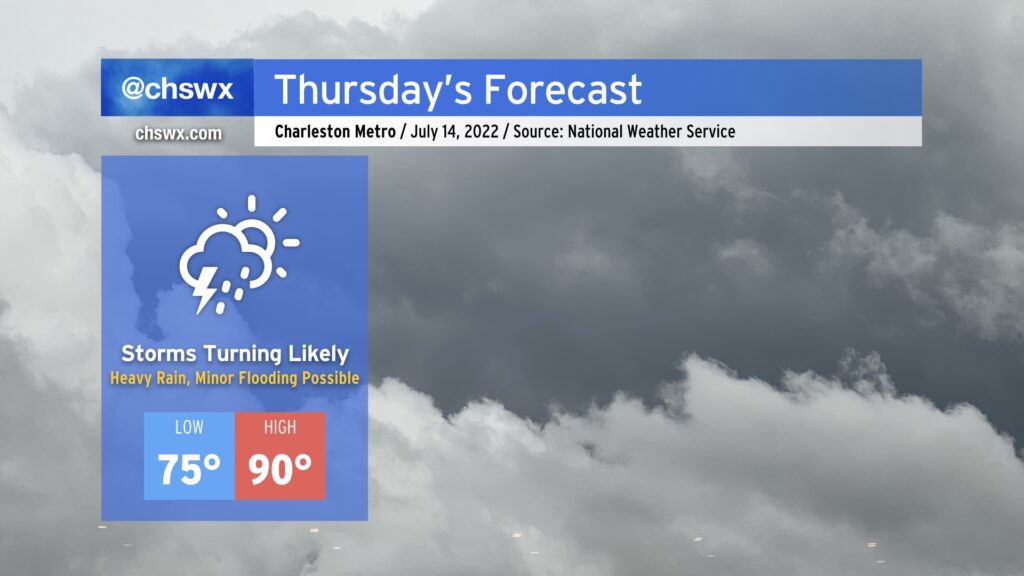
Another front will be approaching the area on Thursday, and this will bring a renewed round of heavy showers and thunderstorms in the afternoon and evening hours, one or two of which could be on the strong to severe side with damaging wind gusts. The main concern, though, will be the potential for very heavy rain. We’ve gotten pretty waterlogged in the past few weeks, and continued heavy rain on top of it will lend itself to the risk of some flooding.
It will be another sauna day, with highs topping out around 90° and heat indices rising into the low 100s thanks to the continued stifling humidity that’s blanketed our neck of the woods for the better part of July. The heat and humidity should help fuel-wise for showers and thunderstorms in the afternoon.
Friday and the weekend: Still soggy
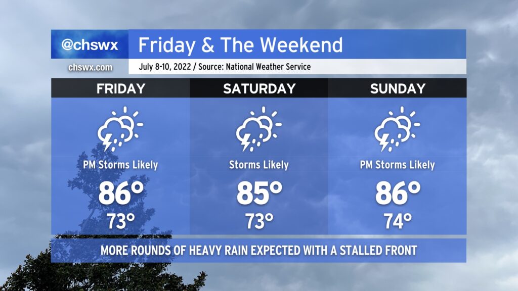
The soggy trend continues for Friday into the weekend as the front lingers in the area, helping to spawn numerous showers and thunderstorms primarily in the afternoon and evening hours (though a shower or storm can’t be ruled out at pretty much any time). The main concern with these storms once again will be heavy rain, potentially causing flooding at times. Another 1-2” of rain seems probable for many of us, with locally higher amounts expected. The widespread shower activity will help keep high temperatures down in the mid-80s each day this weekend, but factor in the humidity and it’ll still feel like the mid-to-upper 90s.
We look to stay in this busy pattern through the beginning of next week before a more summer-like pattern once again sets up across the area, bringing temperatures back to the 90s and limiting storms to isolated and scattered coverage by Wednesday.