Friday & the weekend: Standard August fare
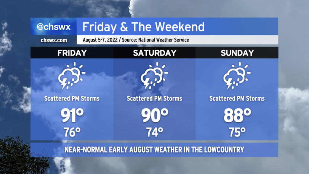
Atlantic high pressure keeps us appropriately warm and muggy by early August standards for tomorrow into the weekend. Onshore flow will help air temperatures run in the upper 80s to low 90s each afternoon, while humidity will make it feel closer to the upper 90s and low 100s.
The aforementioned onshore flow keeps a chance of showers in the forecast Friday morning closer to the coast. Rain chances will migrate inland with time, with a few thunderstorms possible as the seabreeze pushes inland across the area during the afternoon and early evening hours. Saturday’s setup looks similar, too, though the NAM nest is a little less excited about morning showers. Sunday could be a little more active as what looks like a weak TUTT (tropical upper-tropospheric trough) whirls into the area from the east, helping to enhance shower and storm coverage across the area. Overall, the risk for severe weather remains low, but as always, lightning makes every thunderstorm dangerous. When thunder roars, go indoors!
Tropical update: Updated hurricane season outlooks from NOAA and Colorado State still paint an active picture
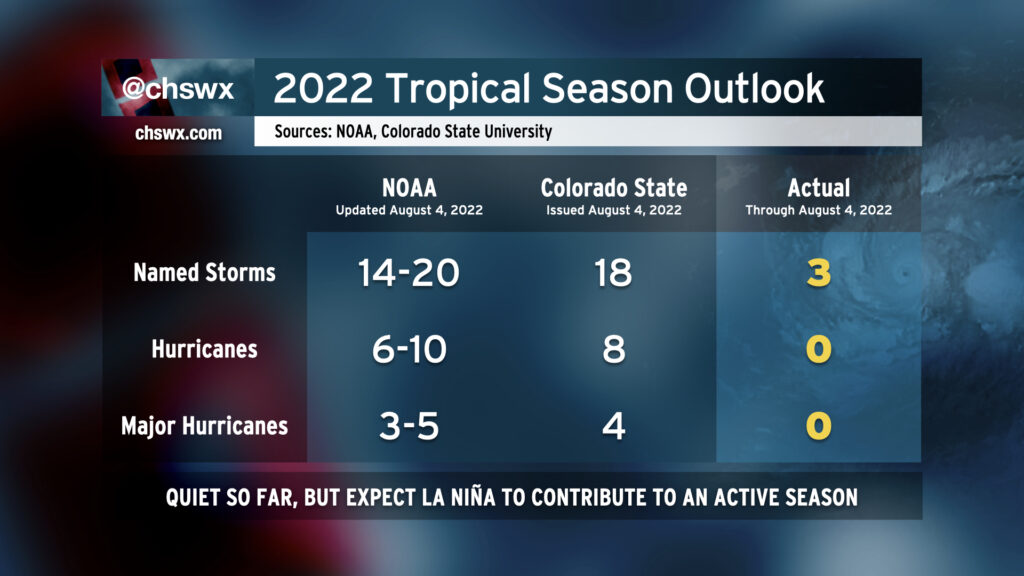
NOAA and Colorado State released updated projections for what we can expect from the rest of the 2022 hurricane season today. It’s been reasonably quiet to this point — just three named storms, including Colin which gave us a brief brush back in June. However, La Niña remains in place, sea surface temperatures remain quite warm, and ensemble guidance shows the pattern is showing signs of flipping as we head toward the climatologically busy part of the season from mid-August to early October. As a result, both seasonal forecast outfits continue to project another above-average season across the Atlantic. NOAA is predicting 14-20 named storms, with 6-10 of those becoming hurricanes. Three to five of those storms may become major hurricanes (Category 3+ on the Saffir-Simpson Wind Scale). Colorado State is projecting another 15 named storms on top of the three we’ve already had, with eight of those becoming hurricanes and four of them reaching Category 3 or higher.
As always, seasonal outlooks do not take into account how many storms make landfall, simply how many form. Remember: It only takes one poorly-placed storm to make a season memorable for all the wrong reasons. Take advantage of the quiet time by reviewing your hurricane preparedness plan. It’ll be a lot less stressful now than when a storm is bearing down, that’s for sure.
The good news…
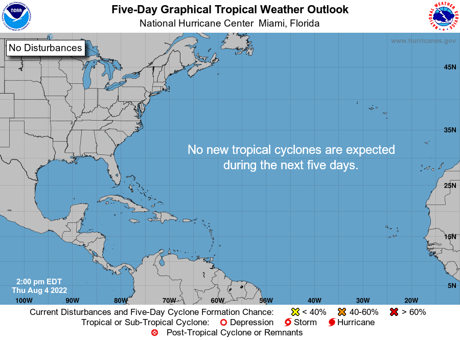
The good news, though? NHC has no areas of interest on the map going out five days. We love to see this map and hope it continues, but we’ve gotta be ready for when it lights up later this summer and into fall. For now, enjoy the quiet!