Friday & the (Labor Day) weekend: Remaining unsettled
Well, today was supposed to feature a lull in the shower and storm action, with more isolated coverage…and then it rained for five hours, flooding downtown Charleston again while 3-5″ of rain dumped on Johns Island and West Ashley. This was due to the combination of a stalled front and outflow from a thunderstorm cluster that developed to our northwest. Add in a little upper-level energy and you have a very, very soggy Thursday afternoon. Thankfully, the bulk of today’s rain is over and we should largely dry out overnight (though with fog a distinct possibility).
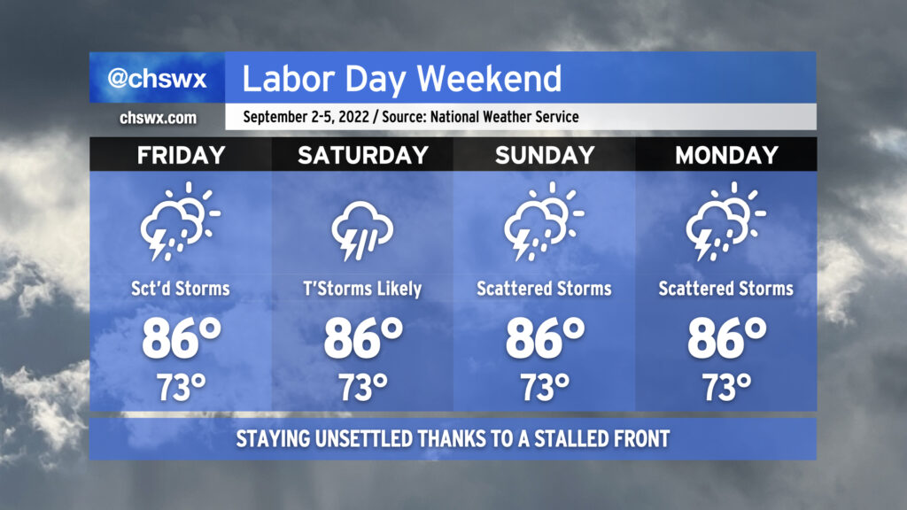
As we head into Friday, scattered storms remain in the forecast as the ever-present front remains close by. The impact on our weather will largely be driven by how far south it slips tonight into tomorrow. Right now, the expectation is that the greatest concentration of storms will be to our south and west, but I do anticipate that we’ll see a few more downpours tomorrow across the metro area, perhaps again having impacts on the evening commute.
Shower and storm coverage is expected to tick up a little bit more Saturday as onshore flow becomes a little more convergent at the surface. That’ll be the day with the greatest potential for persistent rainfall (at least as currently forecast). There is a little model disagreement with where the surface front will be, though, and so that’ll drive a little uncertainty. Heading into Sunday and Labor Day, rain chances continue to persist, with scattered coverage expected as a coastal trough develops and hangs around. This doesn’t look to be a full-day washout for Labor Day, but be ready to move outdoor activities inside.
With the persistent risk of scattered storms and the ensuing cloud cover, highs should stay in the mid-80s each day after starting in the lower 70s. This is around, if not a touch below, early September normals.