Friday & the weekend: Nice weather persists, but watch for tidal flooding
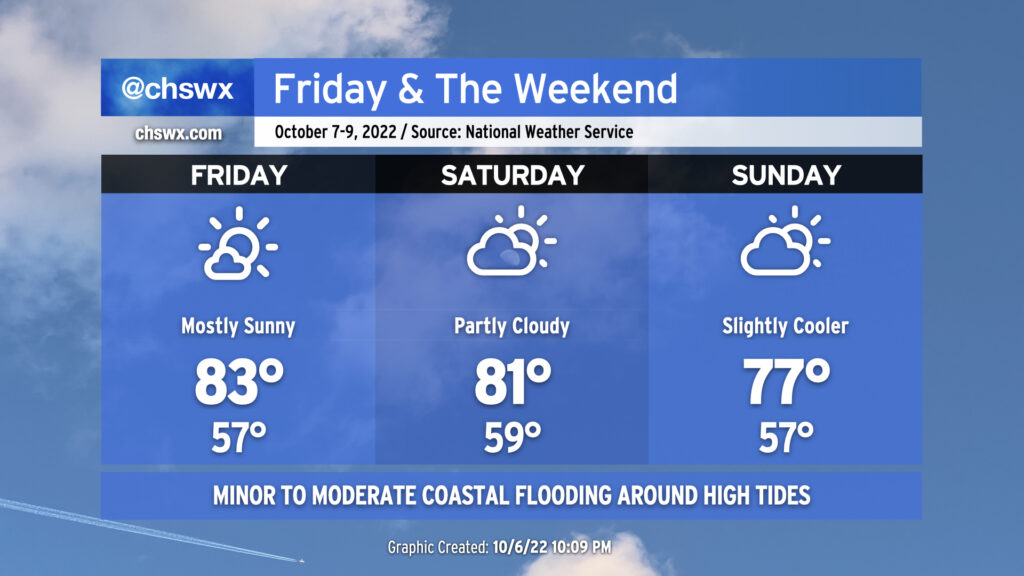
We stay seasonably warm for Friday & the weekend, even with a cold front swinging through later Saturday. Friday’s going to be the warmest day of the set with the most unencumbered sunshine and some compressional heating ahead of the cold front helping to drive highs to around the low to mid-80s. A few more clouds will mark the approach and passage of the front Saturday, but no rain is expected; expect temperatures back in the low 80s ahead of the front Saturday afternoon. Winds go northeasterly on Sunday and will help to cool things down a touch. Expect highs to run in the upper 70s, generally a few clicks below early-to-mid-October normals, but not quite the chill we saw in the immediate wake of Ian last week.
Coastal flooding to punctuate high tides this weekend, approaching major flood stage at times
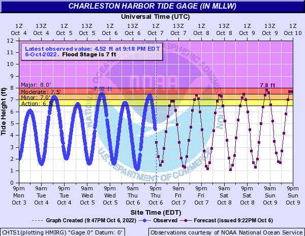
The fly in the ointment amongst all this generally nice weather will be the risk for coastal flooding around times of high tide through at least early next week. Tomorrow morning’s high tide, which should occur around 6am, should top out just shy of flood stage. From there, though, minor to moderate flooding becomes a concern through Saturday evening’s high tide. Once the cold front comes through later Saturday and winds go northeasterly with high pressure building in, we’ll see a further uptick in water levels in the harbor. Expect tides to top out well into moderate flood beginning Sunday morning, with major coastal flooding not out of reach with morning high tides through early next week. These tides will cause periodic road closures in parts of downtown Charleston, with more numerous road closures possible as water levels approach 8′. Keep an ear out for Coastal Flood Advisories from the National Weather Service.
Tropical update: TD Twelve just about done, TD Thirteen a possible hurricane threat to Nicaragua
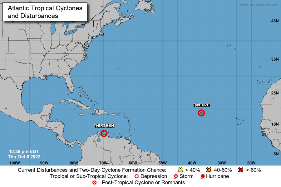
NHC has issued its final advisory on the remnants of Tropical Depression Twelve in the far eastern Atlantic, and earlier today initiated them on what is now Tropical Depression Thirteen. TD Thirteen should become a tropical storm by tomorrow, and may eventually threaten Nicaragua as a hurricane over the weekend. The NHC forecast is locked in on a mostly due-westward course for TD Thirteen, and as such, it poses no threat to the Lowcountry.
Elsewhere, the tropics are quiet, with no other areas of interest. (Let’s try to keep it that way.)