Thursday: Back to the 80s
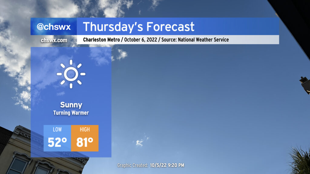
Thursday will be another nice weather day across the area with a seasonable chill to start and comfortable warmth to finish. Lows will once again start in the low-to-mid-50s away from the warmer coastline, but plentiful and virtually unobscured sunshine combined with winds generally out of the southwest will help temperatures reach the low 80s in the afternoon, right on the nose for early-October climatology. Should be a nice day for getting out and about!
Friday & the weekend: Continued nice weather, turning cooler Sunday
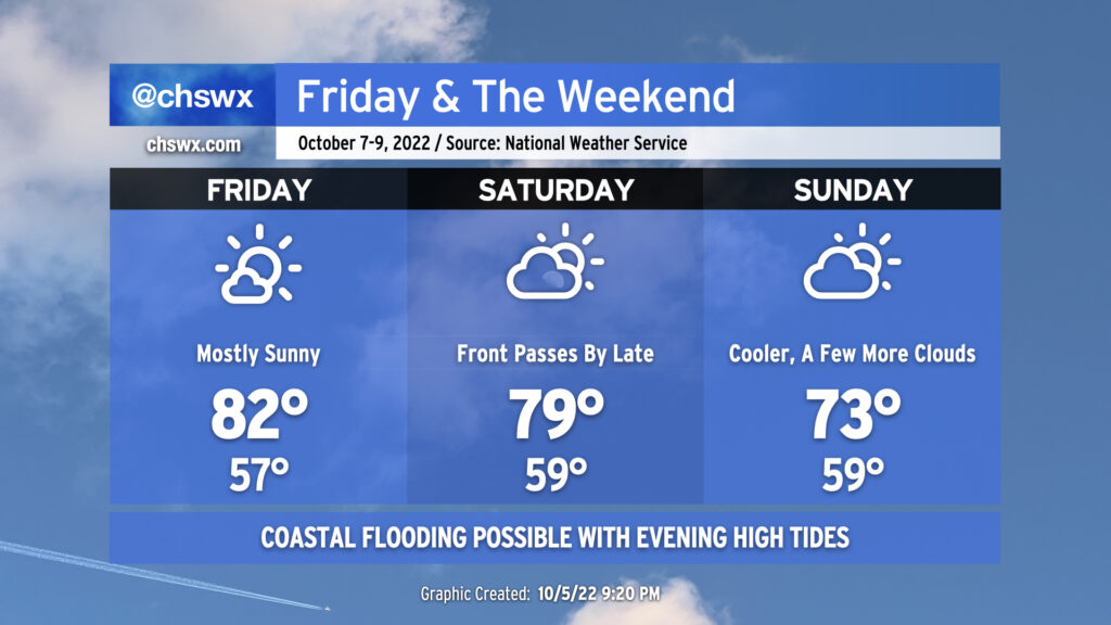
Near-normal temperatures continue for Friday and Saturday ahead of a cold front which currently looks projected to swing through later Saturday. Friday’s highs top out in the low 80s, while Saturday should top out around 80° before the front moves by. Precipitation is unlikely to accompany the front given a dearth of moisture expected in the area. Sunday will be noticeably cooler in the afternoon, with highs only reaching the low-to-mid-70s as winds swing northeasterly with a little more cloud cover to speak of as well.
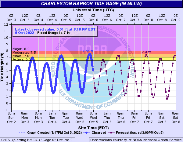
The only weather hazard of note for the next several days is the continued risk for coastal flooding with the evening high tides. Today’s high tide topped out at 7.52′, a little higher than the moderate coastal flood threshold. We should see a similar performance from the tide over the next several days as we head toward a full moon. If Downtown is part of your commute, particularly heading west toward West Ashley, be ready for the potential for some delays due to coastal flooding over the next couple evenings. The coastal flooding forecast generally stays within the minor to moderate range, but that should still be enough to close some vulnerable roads in downtown Charleston. Stay out of sunny day flooding with your vehicle — that’s salt water, folks, and won’t do well for your car’s undercarriage! Turn around, don’t drown (your resale value).
Tropical update: TD Twelve barely hanging on, Invest 91L likely to develop in a few days
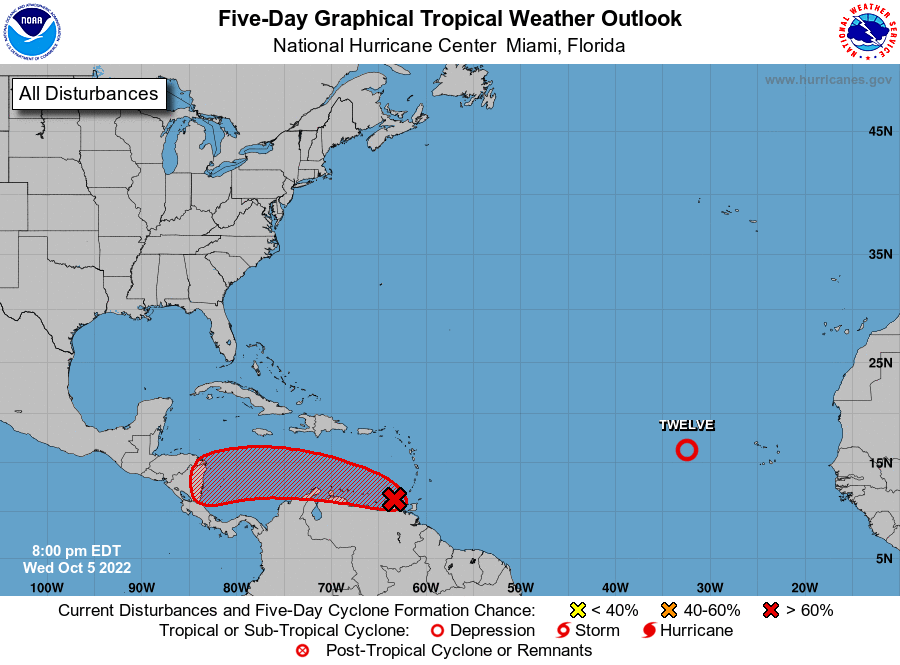
The National Hurricane Center continues to monitor two areas of interest this evening. Tropical Depression Twelve is barely hanging on west of the Cabo Verde Islands this evening. NHC doesn’t give it much more time, with it expected to lose tropical characteristics possibly as early as tomorrow and for it to dissipate by Friday. As a result, Twelve is no threat to us here at home.
Invest 91L, which is moving across the Windward Islands into the Caribbean, remains likely to develop into a tropical cyclone over the next few days. Land interaction is holding it back a little bit for now, but NHC gives it 90% odds to develop within the next five days as it moves toward Central America. Guidance continues to be in lockstep with a track generally toward the Mosquito Coast of Nicaragua as expansive ridging over the Gulf keeps steering basically due westward. As a result, confidence is increasing that 91L is not a threat to the Lowcountry, much less the continental US.
Elsewhere in the tropics, things remain generally quiet as we descend from the mid-September peak of the season.