Rest of the work week: Unseasonable warmth yields a little by Friday; coastal flooding each morning
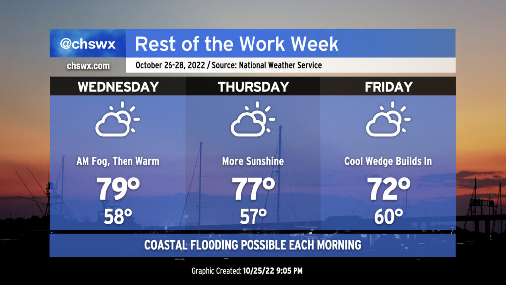
We look to get off to another foggy start Wednesday morning, at least in spots, as temperatures bottom out just shy of 60° in the morning. We may not see quite the density nor the duration that we saw Tuesday morning, but still, be ready to use those low beams and allow extra time to get where you are going. Once any fog burns off, warm advection ahead of a cold front will help temperatures get to near 80° in the afternoon under partly cloudy skies.
The front gets through late Wednesday. It looks like it’ll get through mostly rain-free given limited moisture. Once that happens, winds will go around to the north and northeast and begin to bring some cooler air into the area. The persistent northeast winds will cool things down even further for Friday as highs only top out in the low 70s as cloud cover builds within a strengthening wedge of high pressure.
Coastal flooding concerns increase through the end of the week
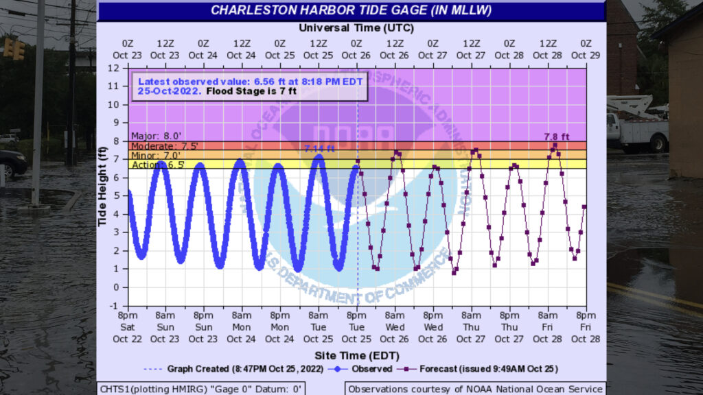
Astronomical influences and increasing meteorological ones will drive morning high tides well into coastal flooding thresholds through the weekend, with the highest water levels beginning Friday. Wednesday morning’s high tide should peak between 7.3-7.5′ a little after 9am, which should be high enough to close a couple roads in downtown Charleston perhaps during the tail end of the morning commute. As winds flip more northeasterly Thursday into Friday, expect water levels during the mid-morning high tides to begin to head into moderate coastal flooding territory, which will broaden road closures for a time across Downtown and may even be enough to cause some issues in Mt. Pleasant on Long Point Road. Stay tuned for Coastal Flood Advisories from the National Weather Service.