Tuesday: A little warmer with some morning coastal flooding
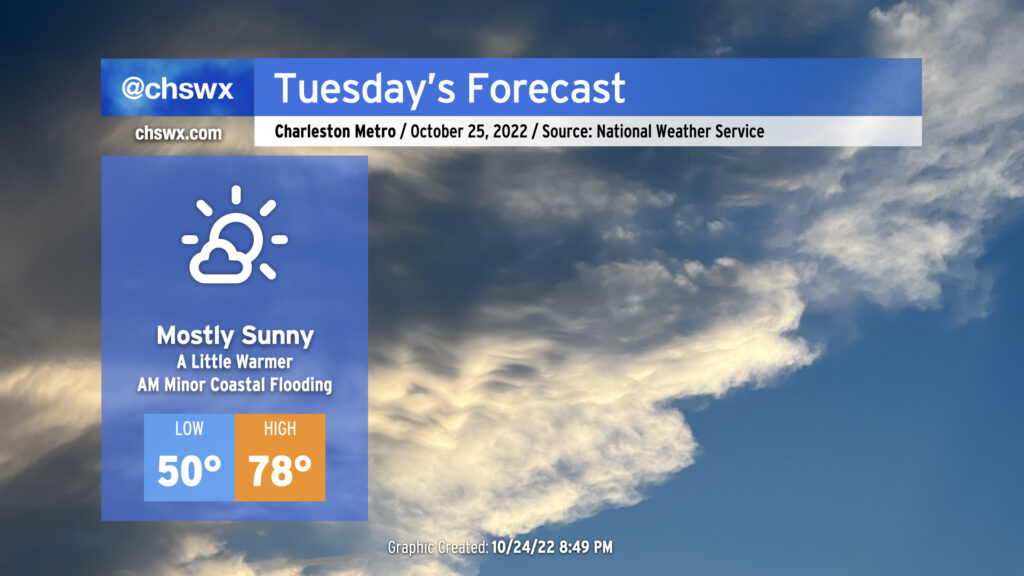
We’ll continue our warming trend on Tuesday ahead of a weak front that’ll come through later Wednesday. After starting around 50° thanks to clear skies and light winds, we’ll warm well into the upper 70s in the afternoon. We should see mostly sunny skies for a good bit of the day, with some higher clouds beginning to thicken later on. Rain-free conditions continue, and it should overall be another good day of weather across the area.
The only weather hazard of note will be the risk for some minor coastal flooding around the 8:20 AM high tide. Right now, water levels are forecast to peak around 7.1-7.3′ in the harbor, which will be enough to perhaps close a couple of the more vulnerable roads on the Charleston peninsula (such as around Hagood and Fishburne as well as near the City Market).
Rest of the work week: Temperatures peak, more coastal flooding
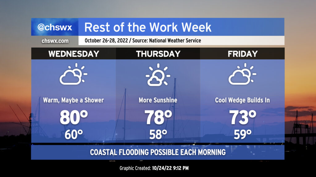
Mild starts and warm finishes punctuate the mid-week period before cooling sets in Friday as a high pressure wedge develops and moisture moves atop it. Temperatures will peak on Wednesday around 80° in the afternoon ahead of a cold front moving into the area. A shower or two can’t be ruled out, but the main forcing mechanisms for any precipitation will be weakening as time goes on. Temperatures behind the front won’t change appreciably for Thursday, with highs once again running in the upper 70s under mostly sunny skies. By Thursday evening, we should start to see an uptick in cloud cover as moisture begins to overrun the wedge of high pressure setting up in the area. On Friday, a mix of sun and clouds will keep temperatures down into the low-to-mid-70s in the afternoon, leading into what could be a potentially showery weekend at times.
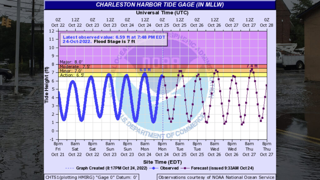
Northeasterly winds behind the cold front and ongoing astronomical influences will continue to keep coastal flooding in the picture each morning through at least Friday. Minor to potentially moderate flooding will be possible around the morning high tides, especially Thursday and beyond. Stay tuned for updates and possible Coastal Flood Advisories from the National Weather Service.