More unseasonable warmth for Sunday
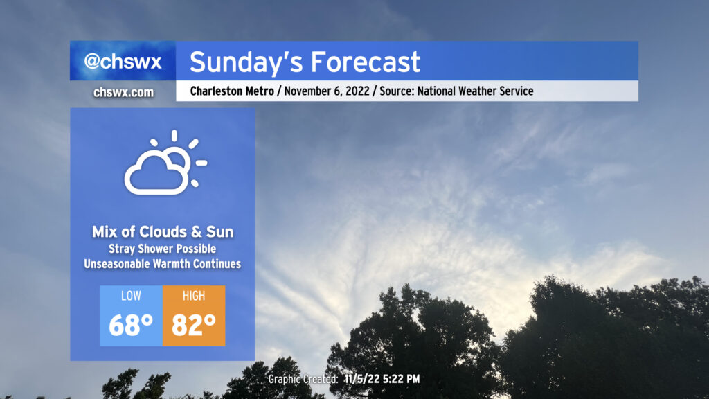
We’ve got another unseasonably warm day on tap for Sunday as an anomalously strong ridge of high pressure aloft continues to extend into the Carolinas. High clouds will favor prominently well ahead of a cold front to our west, but that won’t act as much of a governor on temperatures with low 80s still expected in the afternoon. Indeed, onshore flow is likely going to be the only thing keeping us from approaching the record high of 87° set in 2003.
The morning warmth is almost more remarkable: lows in the upper 60s are forecast, which is getting close to 20° above normal for this point in the year. We should fall shy of the record high minimum temperature of 71° set in 2003, but it does look like we’ll give the record a good run for the money.
A stray shower or two can’t be totally ruled out, but we’ll stay sandwiched between the front to the west and better instability and convergence over the waters and should stay dry as a result.
Finally, minor coastal flooding will be possible with the 6:05 AM high tide as we approach a full moon on Tuesday. Water levels approaching 7′ in the harbor could put some salt water on roads around Gadsden Creek once again — think Fishburne and Hagood — as well as spots along Lockwood (both Drive and Boulevard).
Coastal storm intrigue for next week: future Nicole?
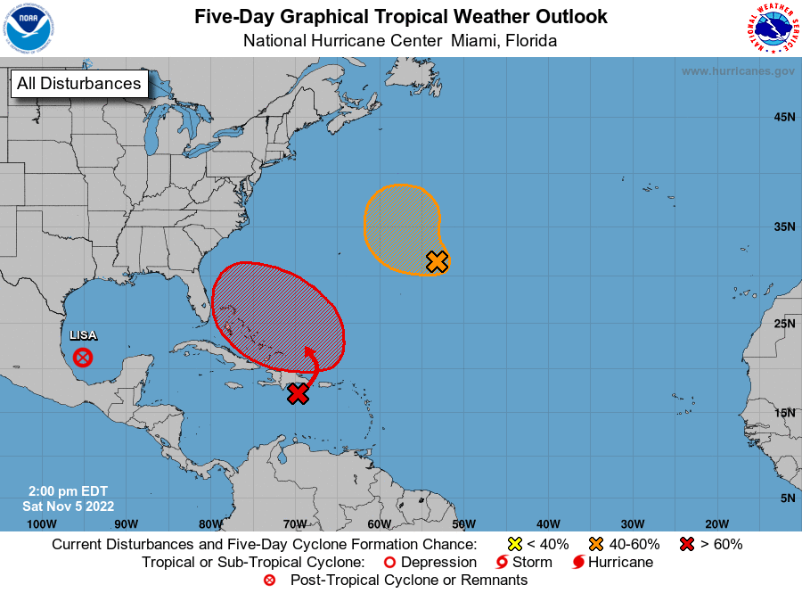
A trough of low pressure near the Bahamas could make the weather a little interesting next week, with the specter of subtropical or tropical storm development certainly in the cards. NHC gives this area a 70% chance of development in the next five days. If it develops into a subtropical or tropical storm, the next name on the list is Nicole.
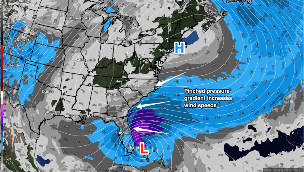
Right now, it looks like this area of low pressure is destined for Florida, but its effects will be felt well up the coast, including here in the Carolinas. We’ll be pinched between the low pressure system to the south and high pressure wedging in from the north. The resulting northeasterly winds will become quite breezy, with gusts 30+ MPH possible at the immediate coast developing by Wednesday (and maybe as soon as Tuesday evening).
These strong northeasterly winds combined with the recent full moon will set up quite favorable conditions for several days of moderate to potentially major coastal flooding around times of high tide beginning Tuesday morning. As these strong northeasterly winds persist, even higher water levels will be possible later in the week. The initial indication from guidance is that major coastal flooding will be a distinct possibility during commute time on Wednesday morning. We’ll certainly want to keep an eye on this carefully for travel disruptions as we get into midweek.
As we head later into the week, we’ll be watching carefully as a cold front is expected to pick up the low and recurve it northeast. Our rain chances look pegged for Thursday and Friday, but how much falls will be determined by the track and strength of the cyclone. The weaker ECMWF is almost a full day slower than the GFS, which shows a fairly tightly wound-up cyclone strafing the Carolina coast with gusty winds and rain as it rides the front northeastward. As you can imagine, there is tremendous uncertainty in this forecast, so stay tuned to updates for more fine-tuning as we get into next week.
Follow my Charleston Weather updates on Mastodon, Bluesky, Instagram, Facebook, or directly in a feed reader. Do you like what you see here? Please consider supporting my independent, hype-averse weather journalism and become a supporter on Patreon for a broader look at all things #chswx!