Tuesday: Warmest day of the week with a few showers
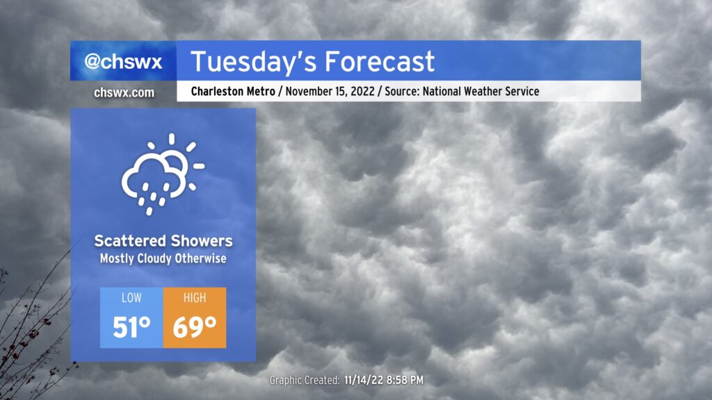
Here comes the warmest day of this week! A coastal trough will move inland during the day Tuesday, which will allow some warmer air to infiltrate the area from the Atlantic. It remains to be seen just how far inland this warmer air can penetrate; we could see some spots near I-95 run much cooler, possibly not getting out of the 50s.
Expect a scattering of showers in association with the aforementioned trough, but it won’t rain all day at any one location. A couple of the models want to bring some instability inland, but the thinking is that any thunder stays over the water. Aside from slick roads from the rain, not expecting much in the way of any hazards from tomorrow’s weather.
Rest of the work week: A reinforcing shot of cold air keeps temperatures well below normal
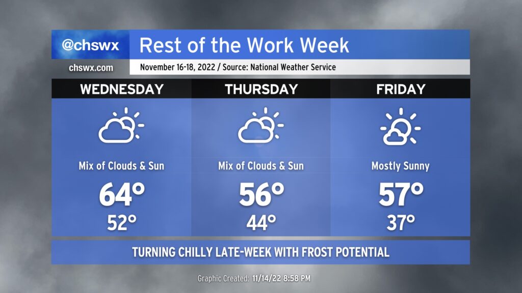
The rest of the work week will stay on the cool side. We’ll see another cold front punch through the area, reinforcing below normal temperatures. Wednesday’s highs in the mid-60s fall to the mid-50s for Thursday in the wake of the front. We wake up Friday well into the 30s — perhaps prompting some frost headlines in the metro area — with highs struggling back into the mid-50s despite probably the most sun we’ll see heading into the weekend.
These temperatures are pretty something, especially Thursday and Friday. Highs in the mid-50s are below normal for mid-January, typically the coolest point in the year in the Charleston metro, much less mid-November. Highs around this point in the year typically top out in the upper 60s to around 70°. Keep the sweaters at the ready!