Thursday: Turning cooler, cloudier, with showers late
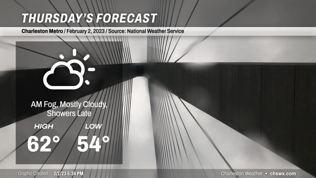
After a record high downtown (77°, breaking the record of 76° set in 1916 and tied in 1950) and just falling short at the airport (81°), temperatures are turning significantly cooler across the area as a wedge front sinks southward tonight. This will result in mostly cloudy conditions for Thursday, with highs running almost 20° below where they did today. Expect some showers to creep back into the area later in the day, with better rain chances settling in overnight into Friday. (Let’s just hope we don’t get caught in a temporal loop on this Groundhog Day.)
Friday and the weekend: Chilly couple days before warm temperatures return Sunday
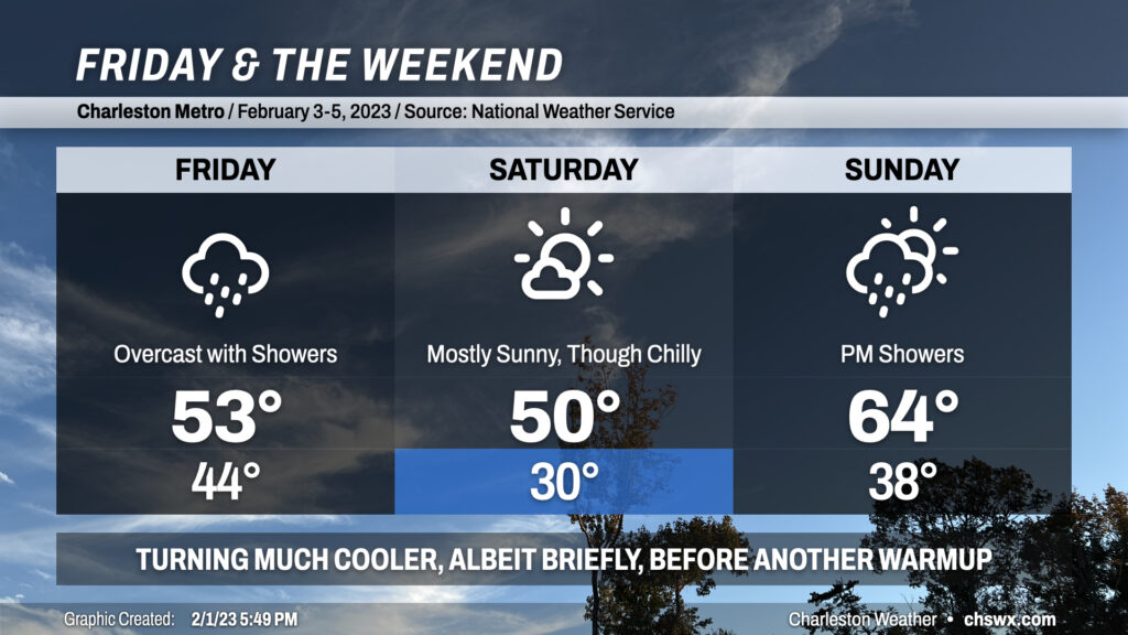
Friday’s going to be a pretty raw weather day with highs topping out in the low 50s if we’re lucky as showers look to persist pretty much all day as low pressure skirts the Gulf Coast to our south, keeping us in the cool sector of the storm for the duration. Showers will scour out overnight Friday and yield a mostly sunny day for Saturday, albeit with a very chilly airmass in place that’ll help us start the day in the upper 20s to around 30°. Highs will struggle to 50° in the afternoon despite the sunshine. We get off to another chilly — but above-freezing — start on Sunday before temperatures rebound into the mid-60s in the afternoon. Shower chances return later Sunday, probably at or after sunset as a coastal trough develops nearby, but most of us look to remain dry. Highs in the 70s return early next week.
Follow my Charleston Weather updates on Mastodon, Bluesky, Instagram, Facebook, or directly in a feed reader. Do you like what you see here? Please consider supporting my independent, hype-averse weather journalism and become a supporter on Patreon for a broader look at all things #chswx!