Tuesday: Chilly start, nice afternoon; turning even warmer to close the work week

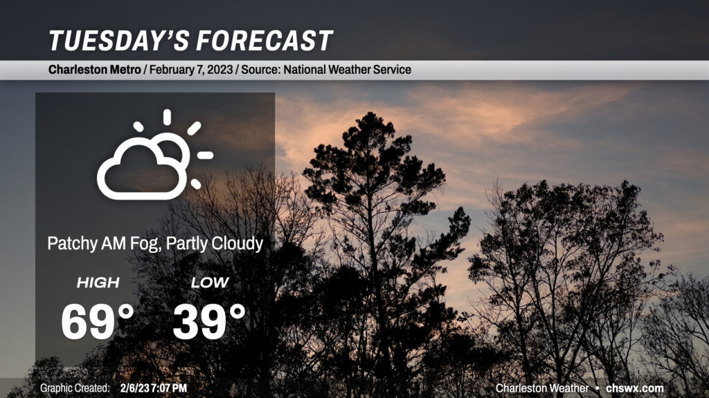
No major weather concerns to write home about for Tuesday. There may be some patches of fog in the morning, but nothing too heinous or concerning (though if you do run into fog, make sure you’re using your low beams and keeping some extra following distance). Otherwise, temperatures around 40° will rise into the upper 60s to around 70° in the afternoon under partly cloudy skies, making for a nice day across the Lowcountry.

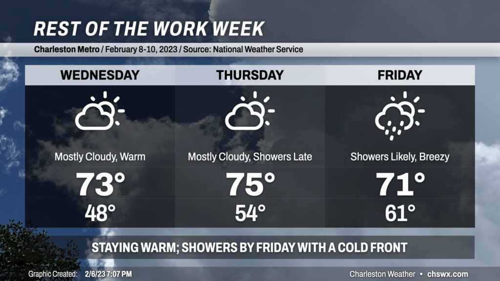
We turn even warmer for the rest of the work week ahead of a storm system that will cool us back off for the weekend. We’ll see more clouds on Wednesday, but highs will continue to top out in the low-to-mid-70s with more southerly winds taking hold. Thursday looks to be the peak of the warmth, with solid mid-70s expected across the area ahead of the storm system. Showers look to begin late Thursday and will last into Saturday morning, with the main rain event on Friday. Highs will still top out in the low 70s on Friday after starting the day in the low 60s — closer to the average high for February 10 as opposed to the average low. Once the front is through later Friday/early Saturday, temperatures will head back to a little below normal for the weekend.
Follow my Charleston Weather updates on Mastodon, Bluesky, Instagram, Facebook, or directly in a feed reader. Do you like what you see here? Please consider supporting my independent, hype-averse weather journalism and become a supporter on Patreon for a broader look at all things #chswx!