Thursday: Warmth peaks before a Friday front and Saturday cooldown
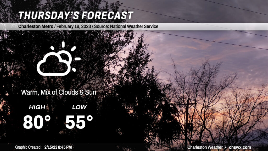
Temperatures topped out close to 80° today in the Lowcountry, and we should meet or even slightly exceed that for Thursday despite a little more cloud cover ahead of Friday’s cold front. We start the day quite mild for mid-February (mid-50s) before soaring to around 80° in the afternoon. Certainly a short-sleeve day for a majority of the day; you’ll shed that light jacket quite early on, methinks.
Friday & the weekend: Cold front brings quick cooldown, but temperatures rebound fast
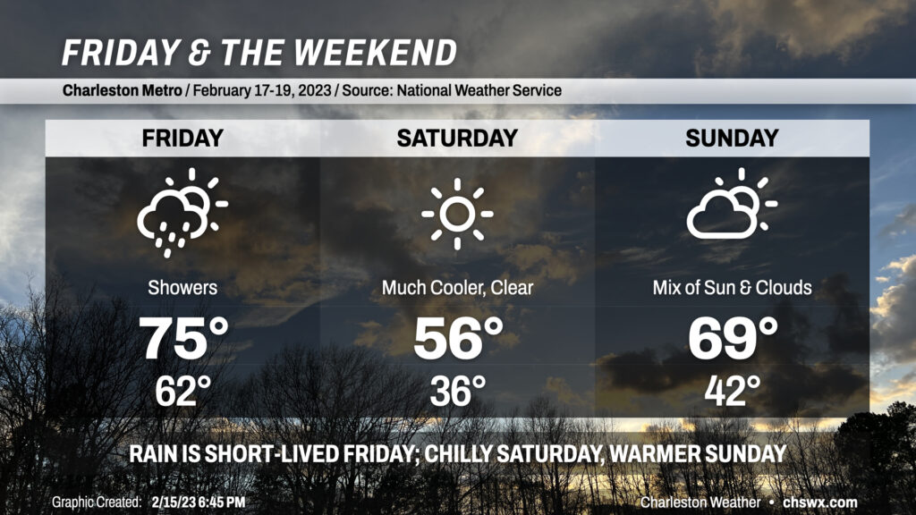
Get ready for a bit of temperature whiplash for Friday & the weekend. Highs top out around the mid-70s on Friday as showers move into the area ahead of a cold front. Said front will knock temperatures down for Saturday — we’ll start the day in the mid-30s ahead of highs only topping out in the mid-50s despite full sunshine as a trough slides atop the region. This cooldown will be relatively short-lived, though, as upper-level flow turns more zonal (think straight west-to-east) and high pressure quickly slides offshore, allowing warmer air to build back into the region. We should top out near 70° on Sunday with a mix of sun & clouds.
The most important thing about this weekend is that it will be the first one since January 7-8 to not feature any measurable rainfall — yes, folks, it has rained every weekend except for one so far in 2023. It’ll be a nice change of pace! I hope you can take advantage.
Follow my Charleston Weather updates on Mastodon, Bluesky, Instagram, Facebook, or directly in a feed reader. Do you like what you see here? Please consider supporting my independent, hype-averse weather journalism and become a supporter on Patreon for a broader look at all things #chswx!