Warmth peaks Thursday, showers arrive Friday, cooler air follows for Saturday
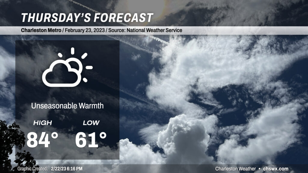
Our warm spell peaks on Thursday on the heels of a second consecutive day where we’ve at least tied the record high. Temperatures will soar into the mid-80s, getting within striking distance of the record high of 86° set just last year. We’ll see a few more clouds ahead of an approaching backdoor cold front, but we look to remain rain-free for one more day.
Friday & the weekend: Backdoor front turns weather unsettled and a little cooler
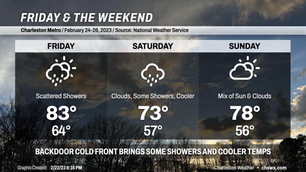
The aforementioned backdoor front approaches the area on Friday, bringing scattered rain chances with it. We’ll stay ahead of the front throughout the day, though, and compressional heating could aid in one more record high falling (84°, set in 2022) before this snap of 80s takes a break on Saturday. High pressure will wedge in behind the front, and some moisture transport atop the wedge will help keep clouds and showers in the forecast throughout the day Saturday (though a total rainout is unlikely). Temperatures will run 10° cooler than Friday, generally peaking in the low 70s (though still well above normal for this point in the year). The wedge then breaks down overnight Saturday into Sunday, allowing clouds to break some and warmer temperatures to return (albeit upper 70s vs. low 80s).
Warm weather continues going into next week, with a brief peak in the low 80s before highs fall back into the mid-70s behind another front. Still, warmer-than-normal temperatures look to stay in force as we depart February and head into March.
Follow my Charleston Weather updates on Mastodon, Bluesky, Instagram, Facebook, or directly in a feed reader. Do you like what you see here? Please consider supporting my independent, hype-averse weather journalism and become a supporter on Patreon for a broader look at all things #chswx!