Chilly conditions continue through Thursday
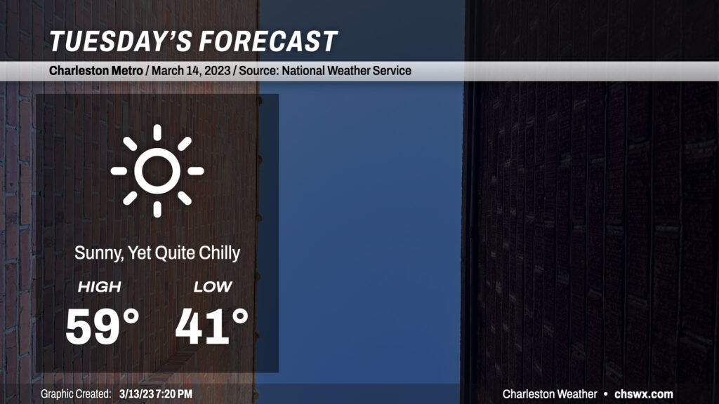
After an unexpectedly cool day in which temperatures did not get out of the 50s for the first time since February 18, we have another rather chilly day ahead for Tuesday despite full sunshine. Air temperatures to start the day will run in the low 40s in the immediate metro area (and cooler than that further inland), but factor in a decent 5-10mph northwest breeze and it’ll feel closer to the mid-30s in the morning.
As the day goes on, freezing levels will drop close to 4,000 feet and occasionally breezy northwest winds will continue to pump cooler air into the area, keeping surface temperatures in the upper 50s at best in the afternoon. This is more in line with early January normals than mid-March. A very dry atmospheric column will preclude anything in the way of cloud cover, so sunshine will be brilliant and unfettered at least, and should make the resulting cool air temperature feel a little better.
Rest of the work week: Frost and freeze concerns Tuesday night; warming up for St. Pats
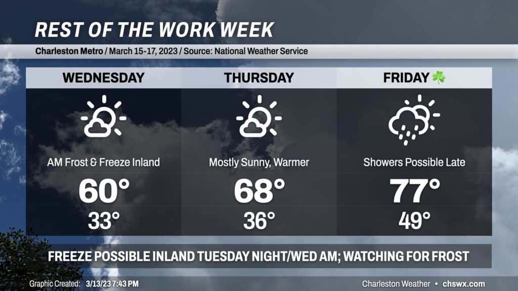
Tuesday night, attention will turn toward the risk for a freeze for the inland tier of counties (Berkeley & Dorchester) as lows drop into the low 30s by Wednesday morning. Frost will be possible elsewhere in sheltered areas, but more widespread frost may be precluded by persistent winds. I encourage y’all to bring sensitive plants in or cover them Tuesday night. To this end, a Freeze Watch is in effect for Tuesday night into Wednesday morning for Berkeley and Dorchester counties. Stay tuned as this may be upgraded to a Freeze Warning by the National Weather Service as confidence in freezing temperatures improves. We may need to repeat this Wednesday night, too; while lows will be a little warmer (mid-30s), frost may still factor in especially with lighter winds forecasted. Keep an ear out for possible Frost Advisories.
Wednesday morning will represent the bottom end of the temperature curve for the rest of the week. Highs rebound to around 60° in the afternoon once again under mostly sunny skies as a little lingering cool advection keeps a lid on temperatures. After the possibly frosty start Thursday, temperatures rebound to near 70° in the afternoon as winds shift to the southeast and warmer air begins to move in. We’ll remain mostly sunny, with just a few clouds from time to time particularly in the afternoon and evening.
St. Patrick’s Day will run starkly warmer than the rest of the week as southerly flow picks up ahead of a cold front. We’ll start the day near 50° with temperatures peaking in the mid-to-upper 70s in the afternoon. A stray shower or two can’t be ruled out late, but right now it appears the bulk of that activity will arrive on Saturday. Stay tuned for forecast tweaks in case you’re out and about Friday night.
Climate notes on today’s cool weather
Today was a much cooler day than forecasted as cloud cover very stubbornly held firm until around 5-6 PM, when it finally started to break up. This yielded some interesting results with the temperature curve today. The high for March 13 will go down in the record books at 58°, but that temperature was recorded at 12:51am. That high, taken at face value, is the coolest since February 18, when the high peaked at 59°. Temperatures during the afternoon peaked around 52-53°, though, and you have to go back to February 4 to find high temperature readings in that neighborhood. So, it will certainly feel warmer tomorrow thanks to much more sunshine!
Follow my Charleston Weather updates on Mastodon, Bluesky, Instagram, Facebook, or directly in a feed reader. Do you like what you see here? Please consider supporting my independent, hype-averse weather journalism and become a supporter on Patreon for a broader look at all things #chswx!