After another freezing start, a (brief) warming trend commences
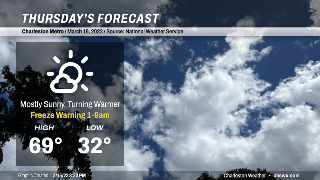
Be sure you’re protecting pets and plants tonight as another period of freezing temperatures will be possible across the metro away from the coast. Even where temperatures don’t dip below freezing, calm winds will make for much more favorable conditions for frost to develop. So, regardless of where you are, be sure to cover those sensitive plants and have loved ones in and warm.
Thereafter, a warming trend will commence as high pressure starts to slip offshore, turning winds a little more southerly. We’ll see highs top out very near 70° on what should prove to be a nice Thursday across the metro area. A few more clouds will begin to fill in later in the day ahead of a cold front.
Friday & the weekend: Cold front moves by, and back below normal we go
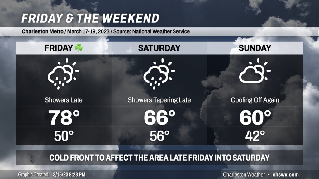
St. Patrick’s Day will be a warm one as southerly winds pick up ahead of a cold front. Gusts 20-30 MPH will be possible at times especially in the afternoon, which may have impacts on any outdoor activities. Expect highs almost 10° warmer than Thursday as they top out in the upper 70s. Increasing cloud cover will likely be the only thing keeping us from a run at 80°. We look to get much of the day in rain-free, though shower chances will be on the increase after sunset as the front draws closer. There’s still some inconsistency in the models as far as rain timing start, though all agree that the best chances for rain arrive at and after midnight.
Showers continue into Saturday morning as the front moves by. Once the front is through, we should see showers taper off and cloud cover begin to dissipate as cooler and drier air moves in. I suspect that we will get at least some dry time in for Saturday afternoon, so don’t write it off as a total loss. Highs on Saturday top out in the mid-60s early in the day as a result of the frontal passage; expect a cooldown as the afternoon progresses and the aforementioned cooler air moves in.
Skies go partly cloudy on Sunday with temperatures heading back below mid-March normals as high pressure builds back into the area. Rain-free conditions will be short-lived, though, as some showers will be possible to kick off the new work week. (But we don’t have to worry about the new work week just yet, do we?)
Follow my Charleston Weather updates on Mastodon, Bluesky, Instagram, Facebook, or directly in a feed reader. Do you like what you see here? Please consider supporting my independent, hype-averse weather journalism and become a supporter on Patreon for a broader look at all things #chswx!