Tuesday: Freeze warning to start inland, but the warming trend begins

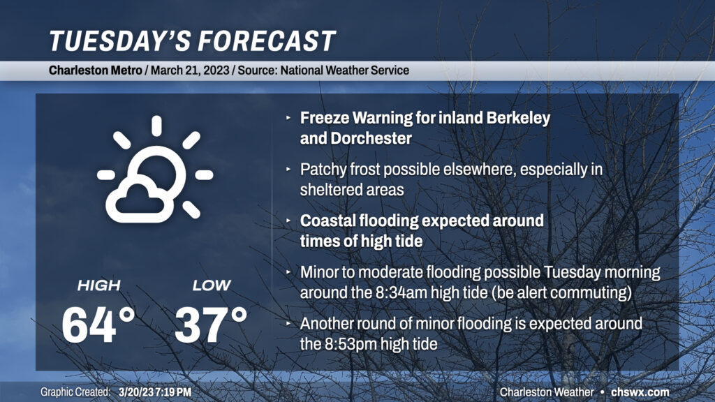
Welcome to Spring! A Freeze Warning is in effect for inland Berkeley and Dorchester overnight into Tuesday morning, with a risk for patchy frost in other sheltered spots. This will be the last one of these for a little while, though, as a warming trend commences. It will be subtle on Tuesday, with highs running in the mid-60s as opposed to the low 60s — still well below climatology for this point in March. Skies will generally run mostly sunny with a few more clouds in the afternoon.
Northeasterly winds and the new moon will combine to produce tidal flooding during the Tuesday morning commute. Water levels could approach 7.3-7.5′ around 8:34am, which should be enough to close a couple roads in downtown Charleston. Be ready for delays if downtown is in your plans, particularly the west side of the peninsula.
Rest of the work week: Back to the 80s

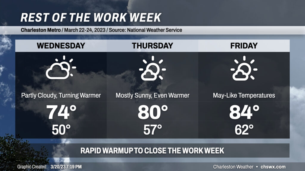
We’ll swing quickly away from below-normal temperatures to above-normal temperatures beginning Wednesday. We start Wednesday significantly warmer, with upper 40s to low 50s across the area as opposed to Freeze Warning-level temperatures. Highs head into the mid-70s in the afternoon. By Thursday, Freeze Warnings will be a distant memory — we start the day in the upper 50s and peak around 80° in the afternoon. The warming trend continues into Friday, with highs in the mid-80s expected across the area under mostly sunny skies.
The next rain chance looks to arrive later Saturday as a “cold” front swings by with a band of showers and maybe even a thunderstorm. Said front won’t have much effect on temperatures, though, with highs in the 80s expected both Saturday and Sunday.
Follow my Charleston Weather updates on Mastodon, Bluesky, Instagram, Facebook, or directly in a feed reader. Do you like what you see here? Please consider supporting my independent, hype-averse weather journalism and become a supporter on Patreon for a broader look at all things #chswx!