Tuesday: Turning up the warmth
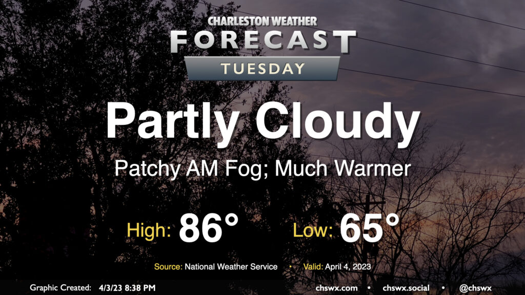
Lingering showers will clear the area overnight, setting us up for a much warmer Tuesday as winds go more westerly and clouds scour out. Expect highs to peak in the mid-80s away from the coast in the afternoon after starting the day in the mid-60s. These temperatures easily run 10°+ above normal for this point in the year, where the normal high is 74° and the normal low is 52°. (The record high for April 4 of 91°, set in 1963, mercifully remains safe.)
Rest of the work week: More warmth heading into an unsettled weekend
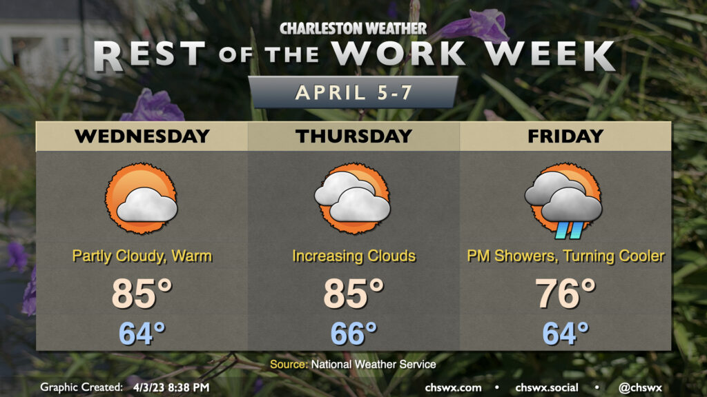
Above-normal temperatures will continue through Friday before a cold front stalls out to our south. Wednesday will feature another partly cloudy day with highs running in the mid-80s once again as ridging takes hold aloft. The ridge will begin to slip a little and clouds will increase ahead of the next storm system on Thursday. Despite the increasing cloud cover, we’ll have one more day of highs in the mid-80s.
We start quite warm once again (mid-60s) before the front trudges through during the day. Highs will top out in the mid-70s with some showers and maybe a thunderstorm along the front as it moves by. The front will stall to our south, leading to a cooler and somewhat wetter weekend.
Follow my Charleston Weather updates on Mastodon, Bluesky, Instagram, Facebook, or directly in a feed reader. Do you like what you see here? Please consider supporting my independent, hype-averse weather journalism and become a supporter on Patreon for a broader look at all things #chswx!