Rest of the work week: Warm, then turning unsettled
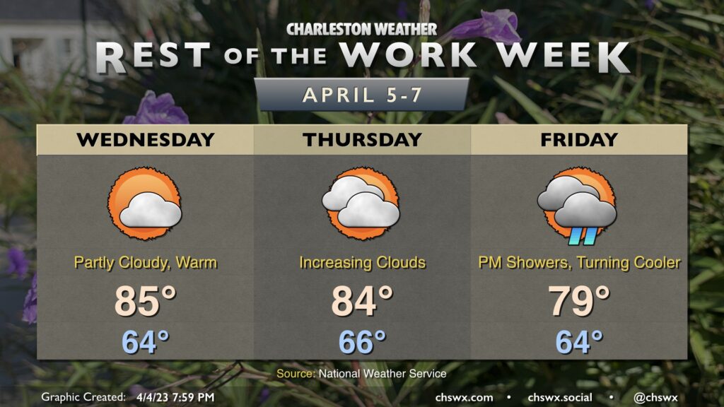
Above-normal temperatures will continue through Friday before a cold front stalls out to our south. Wednesday will feature another partly cloudy day with highs running in the mid-80s once again as ridging takes hold aloft. The ridge will begin to slip a little and clouds will increase ahead of the next storm system on Thursday. Despite the increasing cloud cover, we’ll have one more day of highs in the mid-80s.
We start quite warm once again (mid-60s) on Friday before scattered showers and maybe a thunderstorm or two advance into the area ahead of a cold front later in the day. The frontal passage is looking a little later now, so we should still see highs approach 80°. The front will then stall to our south and high pressure will wedge into the area, leading to a much cooler and wetter weekend in which highs will likely not get out of the 60s.