Thursday: One more warm and rain-free day before an unsettled weekend
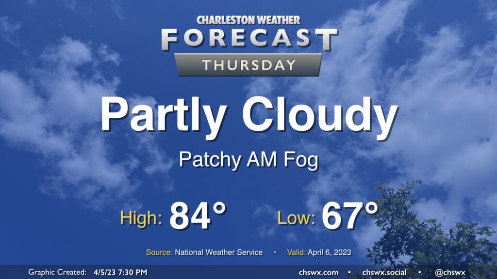
If you’re into highs in the 80s and rain-free weather, try to take advantage of Thursday because changes are in store heading into the weekend. We’ll start the day in the mid-60s, well above normal for this point in the year, before warming back into the mid-80s for the afternoon. (The record high of 90° set in 1967, thankfully, remains safe.)
Friday & Easter weekend: Turning much cooler and rainier

Changes arrive on Friday as a cold front pushes southward across the area later in the day. Showers and maybe a few thunderstorms will be possible ahead of the cold front (though no severe weather is expected) as said front moves by. Highs will peak in the upper 70s and possibly touch 80° depending on when rain begins after starting in the mid-60s for one more day.
High pressure will wedge southward into the area later Friday, setting up a cold air damming scenario that will last through the weekend. Plentiful moisture moving atop the wedge will keep clouds and showers in the forecast for a good bit of the weekend. It probably won’t rain all day, but showers are an especially good bet getting into Saturday evening through Sunday morning. (Take the umbrellas to those sunrise services on Easter!) Once we’re through the weekend, many spots may have received another inch of rain.
Your rain gear should include a light jacket; the cool northeasterly wind, which will be breezy at times particularly on Sunday, will keep temperatures well below normal for early April. Highs will top out in the mid-60s at best, while lows bottom out in the mid-50s on Saturday and around 50° on Sunday.
We’ll also want to watch the harbor’s water levels; while we’re gonna catch a break with the timing of the full moon, the continued northeasterly wind could contribute to water levels approaching coastal flood stage starting with Saturday evening’s high tide. While there’s a lot of spread, guidance indicates that Sunday morning’s high tide could also get near coastal flood levels. We’ll keep an eye on this for any potential travel trouble.