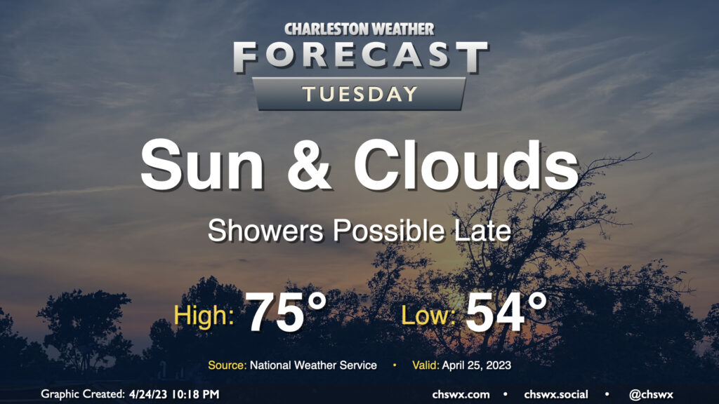
Tuesday: One more largely quiet day before showers return to the forecast

We should get much of, if not all of, Tuesday in rain-free before the pattern changes to something more unsettled to finish up the work week. We start Tuesday in the mid-50s; cloud cover and continued northeast flow will inhibit temperatures from rising much higher than the mid-70s in the afternoon. Some of the higher-resolution guidance has some isolated to scattered showers breaking out later in the afternoon into the evening hours as high pressure loses its grip on the area, but not everyone will see rain.
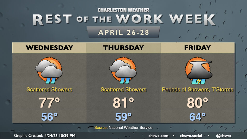
Rest of the work week: Periods of unsettled weather

The weather turns unsettled beginning Wednesday through the rest of the work week as a series of impulses affect the area aloft, while a warm front at the surface gradually lifts northward through the area. Scattered showers will be possible beginning late Tuesday into Wednesday, lasting into Thursday (with possibly a couple thunderstorms as well later in the day). Even higher coverage of showers and thunderstorms is expected Friday as an impulse aloft moves on by. The risk for any severe weather looks fairly limited right now, but a stronger storm can’t be totally ruled out Thursday into Friday within the warm sector.
Follow my Charleston Weather updates on Mastodon, Bluesky, Instagram, Facebook, or directly in a feed reader. Do you like what you see here? Please consider supporting my independent, hype-averse weather journalism and become a supporter on Patreon for a broader look at all things #chswx!