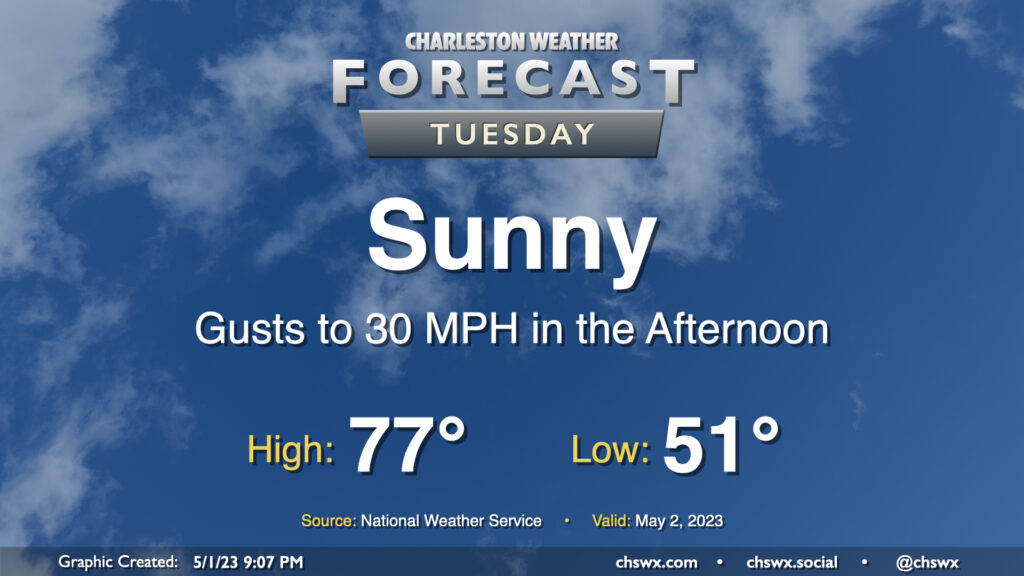
Tuesday: Another bright and sunny — but windy — day

Tuesday looks fantastic by most objective measures — lows in the low 50s followed by mid-70s in the afternoon with plenty of sunshine. The only fly in the ointment remains the elevated wind gusts that will come along with peak heating in the afternoon thanks to deep mixing of the near-surface air that will tap into some elevated winds aloft. That’s about it, though — will be another pretty day with temperatures that at the end of this month I suspect we’ll wish we had back.
Rest of the work week: Predominantly sunny conditions continue

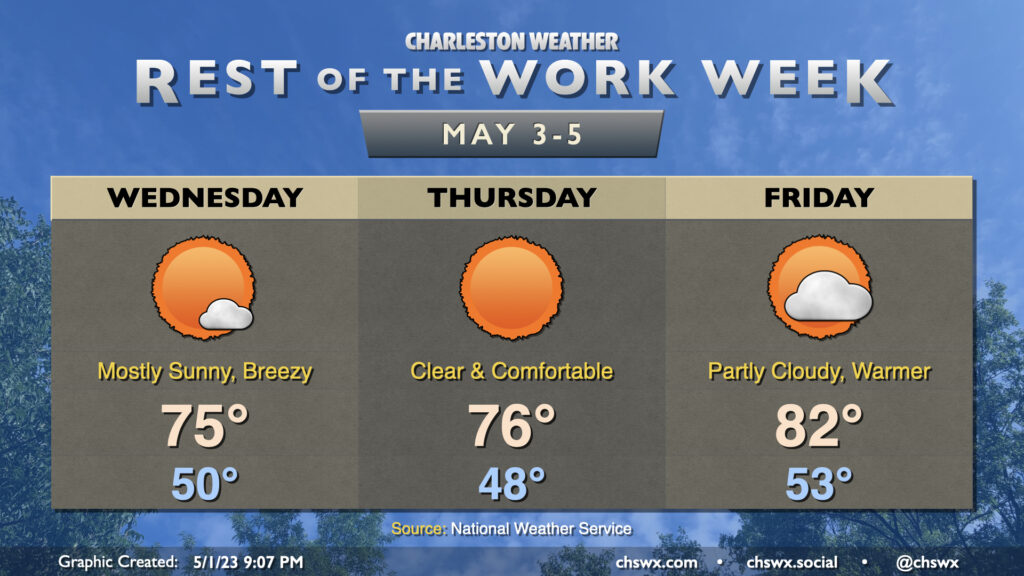
The rest of the work week continues to look quite nice, particularly Wednesday and Thursday, as mostly sunny skies continue across the area under the influence of high pressure. Wednesday should be the last day for gusty winds in the afternoon as the pressure gradient finally loosens up, too. Highs Wednesday and Thursday top out in the mid-70s after starting each day in the upper 40s to low 50s — continuing to run below early May normals.
Friday starts with a similar chill in the air, but winds going a little more southerly as high pressure departs to the east. This will bring a little more warm and humid air into the area, with highs topping out in the low 80s for the first time this week. We’ll also see a little more cloud cover ahead of a cold front which will bring some slight shower chances to the forecast over the weekend, but there should still be more sun than cloudiness.
Follow my Charleston Weather updates on Mastodon, Bluesky, Instagram, Facebook, or directly in a feed reader. Do you like what you see here? Please consider supporting my independent, hype-averse weather journalism and become a supporter on Patreon for a broader look at all things #chswx!