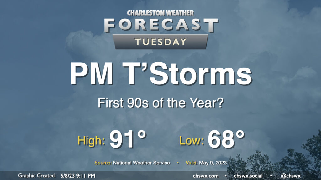
Tuesday: First 90s of the year?

Monday was the warmest day of 2023 so far with a high of 89°, but that distinction will be short-lived as the first 90°+ temperatures of the season look likely on Tuesday ahead of a cold front. Mix in some humidity, and it’ll feel a little more like the mid-90s in the peak of afternoon heating, it looks like.

Later in the afternoon, a thunderstorm complex may develop and move southward into the area. This could bring some stronger thunderstorms into the area, particularly into northern Dorchester and Berkeley where the threat — albeit low — for a strong to severe storm with damaging wind gusts may be most likely. (That’s not to preclude areas further south from a sporadic strong storm, though!) Like Monday, be ready for some showers and thunderstorms to have impacts on the evening commute.
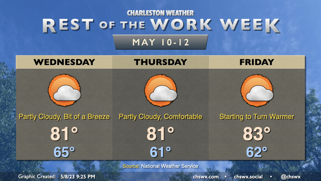
Rest of the work week: A little cooler ahead of an increasingly hot weekend

Post-frontal passage, the rest of the work week will feature temperatures running closer to normals for this point in the year with partly cloudy to mostly sunny skies. Onshore flow will be the main culprit keeping highs in the low 80s each afternoon through Friday before winds start to take a southerly turn once more. It’ll be generally comfortable, with dewpoints dropping to the 50s by Wednesday afternoon and staying in that range for a few days. Enjoy it, because as we get into the weekend, heat and humidity return, with the potential for a return to the 90s by Mother’s Day. (One positive, though: It still looks like high pressure wins the day and keeps the weekend rain-free for only the third time this year!)
Follow my Charleston Weather updates on Mastodon, Bluesky, Instagram, Facebook, or directly in a feed reader. Do you like what you see here? Please consider supporting my independent, hype-averse weather journalism and become a supporter on Patreon for a broader look at all things #chswx!