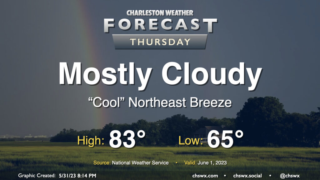
Thursday: Mix of sun and clouds, below-normal temperatures to start climatological summer

Thursday’s forecast is quiet and a little cool for this point in the year as we kick off climatological summer on June 1. Temperatures will generally run a couple degrees below normal on Thursday as cloud cover and a northeast breeze helps to keep things a little on the “cool” side. (Quotes around “cool” because it’ll still be warm and a little muggy, too.) As is customary for June, a shower can’t be totally discounted within this regime, but the vast majority of us get the day in rain-free.
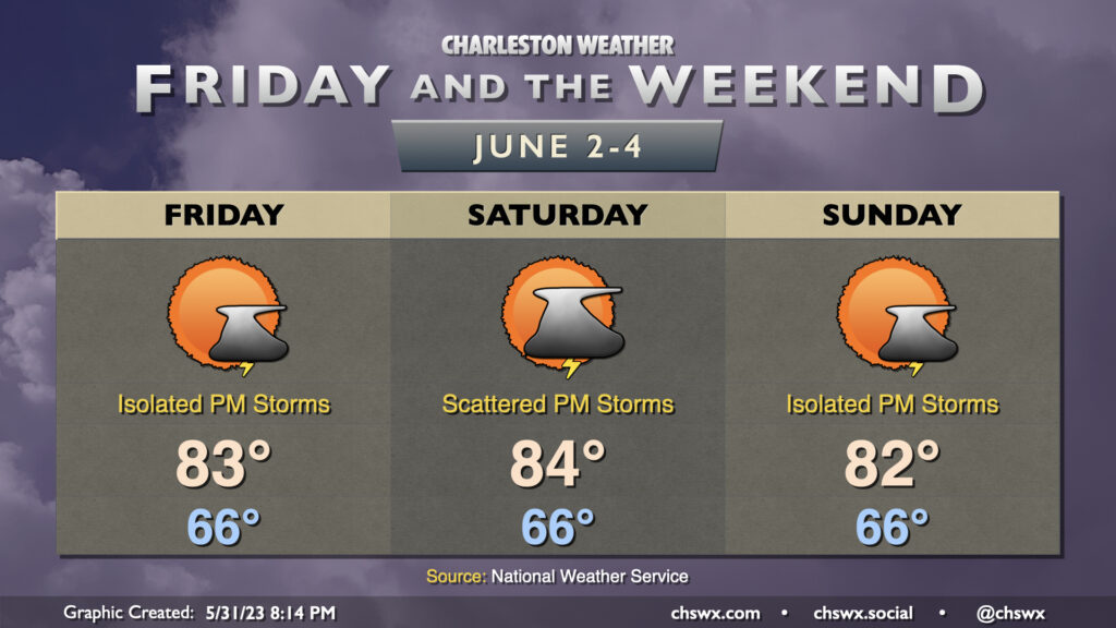
Friday & the weekend: Staying on the cool side of normal, maybe a shower or storm

Temperatures will stay below normal for Friday and the weekend as that cool high pressure remains in place. A seabreeze shower or storm will be possible each afternoon, with a slight uptick possible on Saturday evening as a weak backdoor front drops through the area, but we certainly aren’t looking at a repeat of last weekend. Generally, expect highs in the low-to-mid-80s after starting each day in the mid-60s.
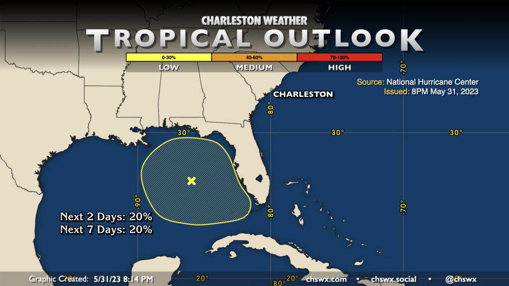
Tropics: Small window for tropical development in the Gulf over the next few days, but no threats to SC

The National Hurricane Center continues to keep an eye on a low pressure system that’s formed in the Gulf of Mexico for a short window of tropical development over the next couple days before it moves over Florida. Guidance is consistent in taking this low across Florida and out of our way, regardless of tropical formation or otherwise. Still, it’s a great reminder that, in fact, hurricane season begins on June 1 — likely when you’ll be reading this!
Follow my Charleston Weather updates on Mastodon, Bluesky, Instagram, Facebook, or directly in a feed reader. Do you like what you see here? Please consider supporting my independent, hype-averse weather journalism and become a supporter on Patreon for a broader look at all things #chswx!